Kings Canyon
Hi There,
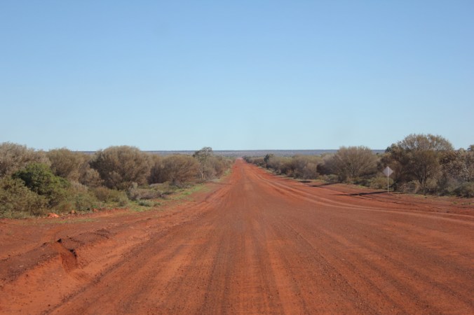
Now I never thought that I would do a nine part and counting series on our three-week holiday to the Northern Territory, but here we are! No need to panic just yet, I can assure you that it wont be long and we’ll be on the home stretch. Meanwhile the stretch of road we were facing now was the Meerenie Loop. A 154km stretch of dirt road which is a short cut to get to Kings Canyon, you can go the long way its only about 500km! For the Meerenie loop you need a permit as it goes through some Aboriginal Land Trust area, also a 4 wheel drive vehicle of some description would be beneficial although not mandatory. I’ve taken the next bit from The Outback Travellers Track Guide Book for Alice Springs to Yulara. “The Meerenie Loop is very undulating with many crests, dips and creek floodways. This area is mainly gravel with some rocky sections but is often plagued with corrugations and dusty conditions”.
 To say it was corrugated and dusty would be a slight understatement to say the least! The first section was an absolute quagmire of corrugations and at a slow speed you felt like you were on some sort of manic rollercoaster, every bump was a shudder of immense proportions. This was going to be great for another 140 kilometres. It did improve though. We decided to see what would happen at a faster speed! Well it was an improvement at a speed of 75-85kmh, mind you it was now a constant smaller shuddering. I can only describe it as a cat the size of an elephant purring beneath your car with the reverberations oozing up into the vehicle and oneself. Everything was just a constant shudder!

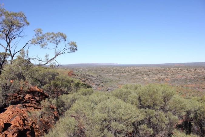
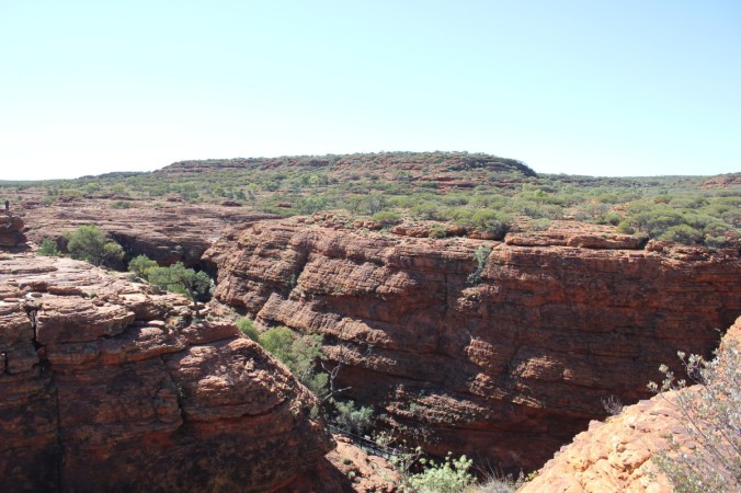
 You can see above the dips and creek floodways, these were the worst. As you approached you would slow down to get across them and occasionally some were quite deep with pot holes in them which the front tyres would slam into with a tremendous thump. It all sounds bad but it was an enjoyable experience and the scenery was quite beautiful. Look at the rolling seam of rock in the left side of the photo above.

 There was a couple of classic road signs we saw, both on 44 gallon drums, one before a corner “LIFT UM FOOT” and the other around the corner “PUTTUN BACK DOWN”. I was too slow in getting any shots but click HERE to check them out! What a classic!. Having stopped for lunch and then continued on our way we soon came to Ginty’s Lookout.
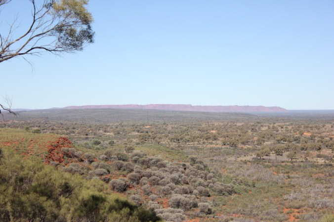
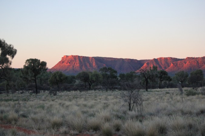
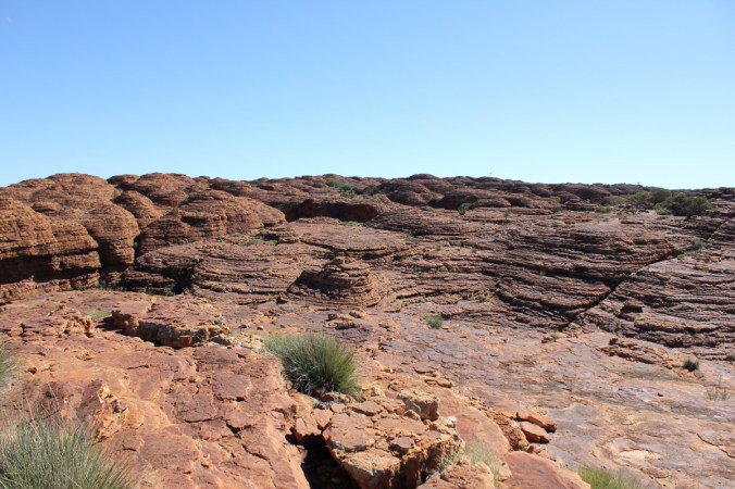
 In the distance you can see George Gills Range and Kings Canyon is at the right hand end of this range in these photos.
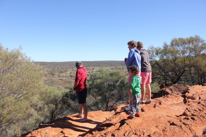
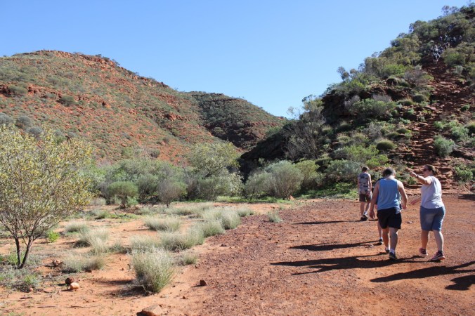
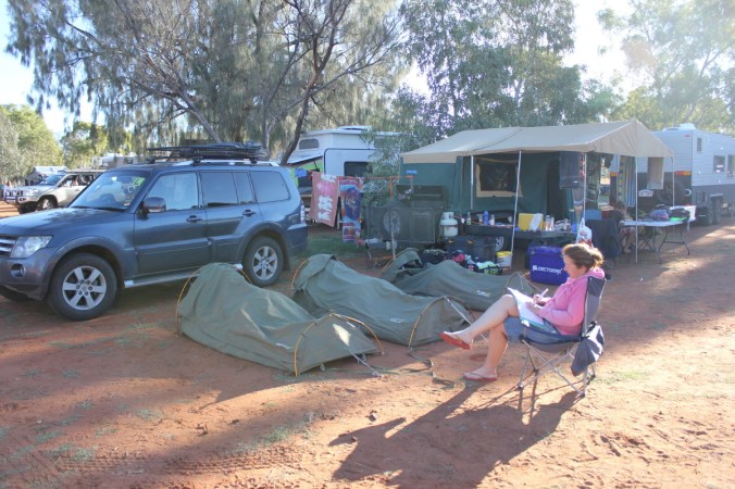
 I think the boys enjoyed a chance to stretch and let off some steam, also gave me a chance to quickly check the vehicle and camper trailer were all in one piece. There was a slight problem with the bike rack attachment on the camper trailer, parts of it had come loose and needed replacement, luckily I had spares!
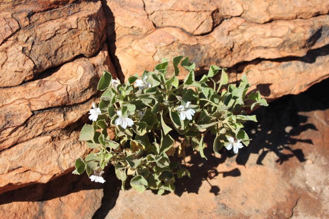
 Of course there were plants to admire, check out this pretty Erimophila!
 Cant remember how long it took to complete our journey along the Meerenie loop but we had finally arrive at Kings Canyon. Just in time to set up camp and then watch the suns rays set on the entrance to the canyon.

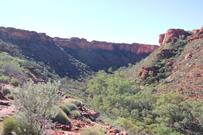
 The next morning dawned fresh and bright and away we went to get amongst the Canyon. Kings Canyon is part of the Watarrka National Park and sits at the west end of the George Gills Range. The walls in the canyon are over 100 metres high and make for some great panoramic views. Here we go on the rim walk which is highly recommended, give yourself at least 4 hours to truly appreciate this place and watch out for the opening climb, it will test you! Make sure you stop on the way up this straight up climb to admire the views, just don’t let on that you’re puffed!
 Here’s one of my scenic views(puff,puff,puff) lucky there was some plants to look at!

 Above is Tall Mulla Mula also known as Pussytails or scientifically as Ptilotus exaltatus. Below is a Blue Bush. Maireana sp, I’m not sure which one, there are 57 specie endemic to Australia.
 Now that I’ve got my breath back, lets continue up the steep climb!
 In the above photo in the middle on the right you can see the car park receding in the distance. Below you can see the canyon walls starting to come into view. The river of green at the bottom is Kings Creek, providing the life blood for those plants.
Once you get to the top the rest of the Rim walk is quite easy and breathtaking at the same time! Firstly you are walking through scrubland and rocky formations before you really get anywhere near the rim. Mind you, you don’t want to get too close to the edge!

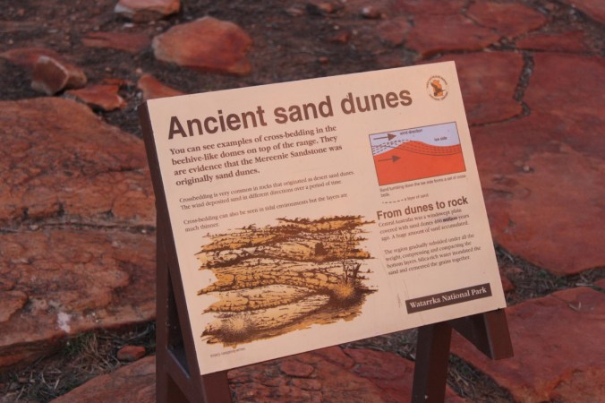
 Picture below is of Sandstone mounds which are quite prolific up on the top of the George Gills Range. They are known as Mereenie Sandstone which has been cross bedded. Basically over time(lots of time) wind has deposited sand in different directions(see description in next photo). The domes you see have been eroded along joint-bounded blocks with rain and wind eroding the corners and sides of the blocks giving us these domed shaped sandstone mounds.
 Looking closely below you will see Rhinoceros Rock. Well that’s what I called it!
 These two photos you can see those Sandstone domes I mentioned earlier.
 Now we come to parts where you need to hold your breath as you edge closer to the edge.
 It is a shear drop off the edge there!
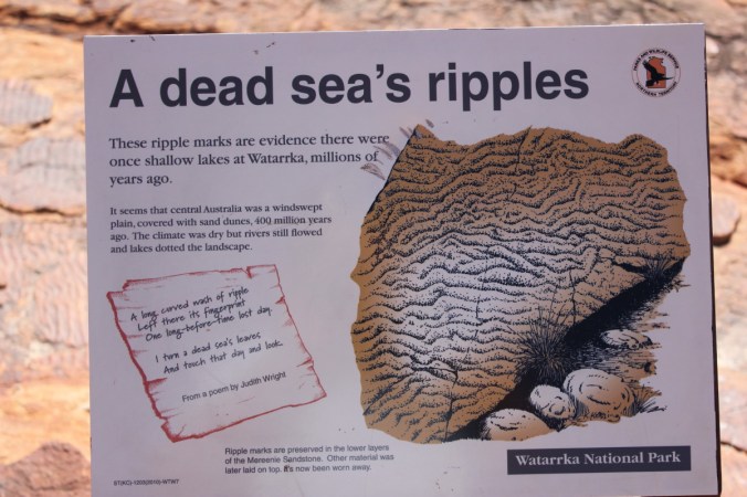
Kings Canyon sits in what is known as the Amadeus Basin which is a intracratonic depression covering approximately 170,000 square Kilometres in Central Australia. Interpret that as an inland sea I would think! Now I will quote the Geology of Kings Canyon National Park by L. Bages, report 4 for the Northern Territory Geological Survey. “The oldest exposed rocks in the park are those of the shallow-marine to continental Cambrian Pertaoorrta Group. This group is conformably overlain by the marine Cambro-Ordovician Larapinta Group which is conformably overlain by the shallow-marine Mereenie Sandstone. The sequence was gently folded, faulted and partly joined during the Alice Springs Orogeny between 400-300 million years ago. Since the Carboniferous, the area has undergone a long period of erosion. During the Tertiary, the climate was tropical; fluvial sediments were deposited in places and silcrete and ferricrete were formed. During a period which lasted from the late Tertiary to the Quaternary, acolian sand dunes and sheets, which now cover large areas in Central Australia, were deposited under arid conditions.” Did you get all that?? Basically means what a fantastic landscape we are looking at now!! Here we have the ocean floor with ripples in it, incredible!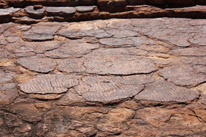
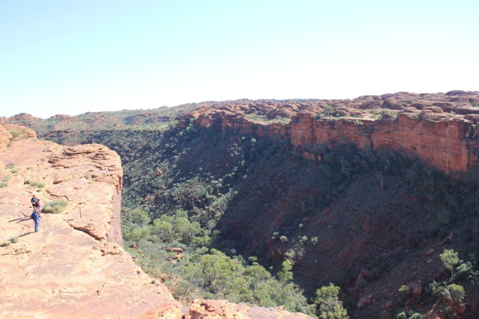
 Above we are looking out towards the car park and yes, the views are quite beautiful.
 Yes you are correct, those are people on the opposite side of the canyon looking over the edge! No fences here! Scary!
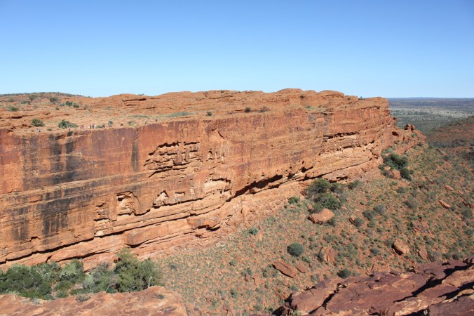
 Not a great photo below but just showing a chasm(Joint) and the cross bedding(layers) in the sandstone.
 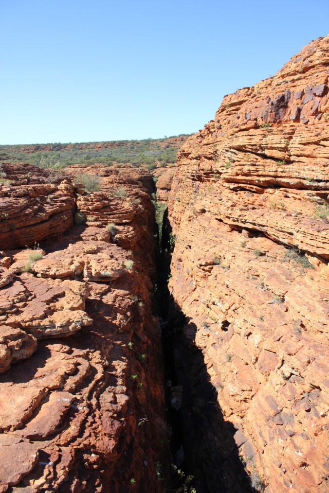 Lets have a look at a few of the plants up here. The Desert Heath Myrtle, Thryptomene maisonneuve were in full flower. These Thryptomenes are widespread throughout arid Australia and can grow to 1.5m high.
The ones on top of Kings Canyon in the open were quite close to the ground to get out of the wind!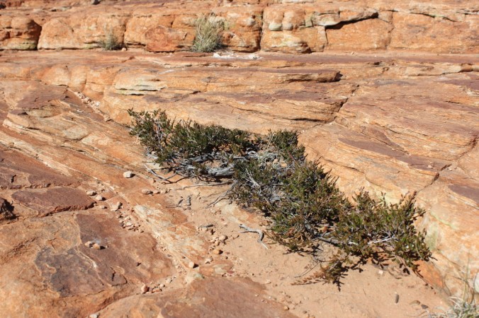 Below is Macrozamia macdonnellii, The Macdonnell Ranges Cycad, interesting to see cycads out in arid country!
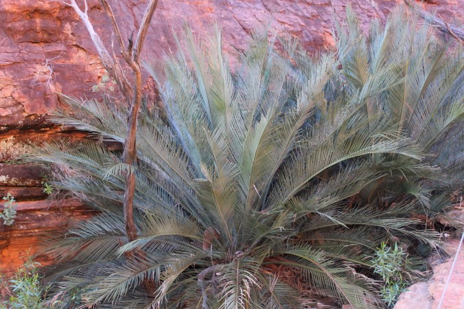 This one below looks like some kind of Hibbertia sp. Also know as Guinea Flowers, pretty nether the less.
 Not sure of this one, obviously situated in the Daisy family, could be a Calotis or a Minuria or some form of Brachycome or I could be totally off the money. Nice flowers though!
 This is Pandorea doratoxylon which we saw at Serpentine Gorge .
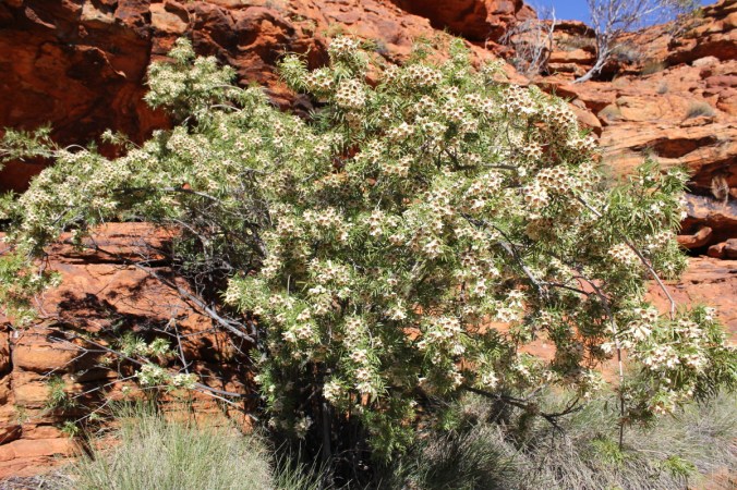 This is the stunning Holly Leaf Grevillea, Grevillea wickhamii.
 A shrub or small tree 1-4m or even 8m tall in places, seen in Western Australia and inland Northern Territory.
 We’ll leave the plants alone for a little while and head back into the scenic elements of Kings Canyon.
 Below we are looking into the Garden of Eden, an oasis in the middle of Kings Canyon fed via Kings Creek which creates a sublime environment in the heart of this arid country.
 Look at the reflection in the water, beautiful!
 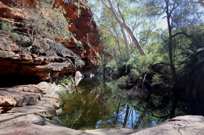 Here is a stand of the Macdonnell Ranges Cycads.

 Check out these reflections! Not Bad!
 The one below is actually taken looking directly into the water!
 Staircase leading out of the Garden of Eden and on towards the rest of the Rim Walk.
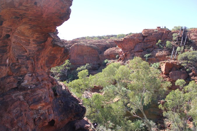 Here we are around the other side of the rim. That edge to the right of those people is a straight drop of about 100m or more and then maybe double that to Kings creek at the bottom, scary stuff!
 On this Sandstone cliff you can see the horizontal layers that have been laid down over time.
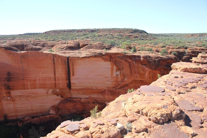 Wow!
Wow!

 A bit more information above and no we didn’t smash any rocks to check the insides!
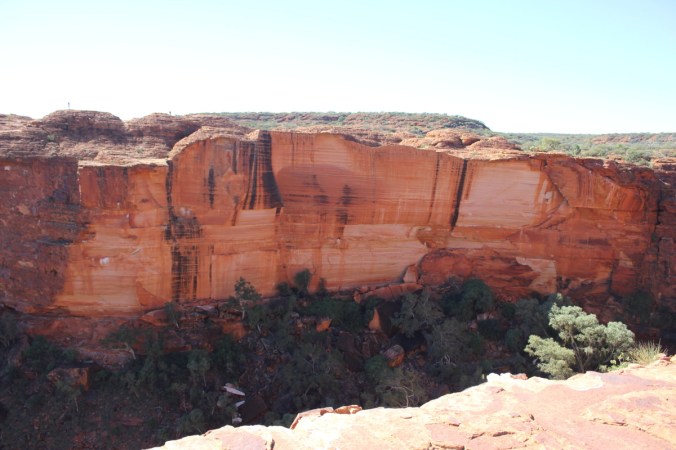 The colours were truly amazing!
The photos below show to good effect the Sandstone domes and layers

 I like this one above, it shows a couple of fault lines running in different directions. We are now on our way back towards ground level and the finish of the Rim Walk, a few more plants have caught my eye! I think this one is either a Goodenia, Lechenaultia or Velleia sp. Pretty little shrub on the sandstone hills on top of the canyon.
 This one below is quite possibly Goodenia cycloptera.
 Plants have an amazing knack of growing anywhere, have a look at this fig below.
 This one below looks like a bit of an oddity and haven’t been able to work it out yet!
 A few more pics of Ptilotus exaltatus.

 Here’s a good photo of one we’ve seen before, Solanum quadriloculatum.
 This is Kestrel Falls, apparently where lots of Kestrel’s roost and also some good waterfalls here during the wet season.
 A few more plant photos showing the tough environment here.


Well I must admit that’s about it. It was a big day and everyone enjoyed it even though we were tired!
 It was good to sit down again!
 Cheers!
Pingback: A trip to the Northern Territory. Part 12b. | huon perennials
Pingback: A trip to the Northern Territory. Part 13. | huon perennials