The End Approaches.
Hi There!
You may have guessed from the last post or even from the heading above that our trip to the Northern Territory was drawing to a close. In some ways it was good to think that we would be home soon because really deep down at the bottom of your hearts there is no place like ‘HOME’. This old saying(if that’s what it is) is so true on so many levels it’s not funny! In other ways it was sad to be leaving the Territory, this natural beating heart of Australia Its grandeur, its beauty, its harshness, its isolation, its story, its cultural significance and many more its. We have only seen but a portion of it.
Our last day here dawned bright and clear albeit slightly chilly. We were of to have a camel ride! These animals having been introduced to Australia, certainly have taken a likening to the Outback and many thousands, roughly 300,000(2013 estimates after a cull which started in 2009, which estimated there to be 600,000 in 2009) roam the outback. Apparently we are the only country in the world with feral herds of camels and the largest populations of them, seriously??
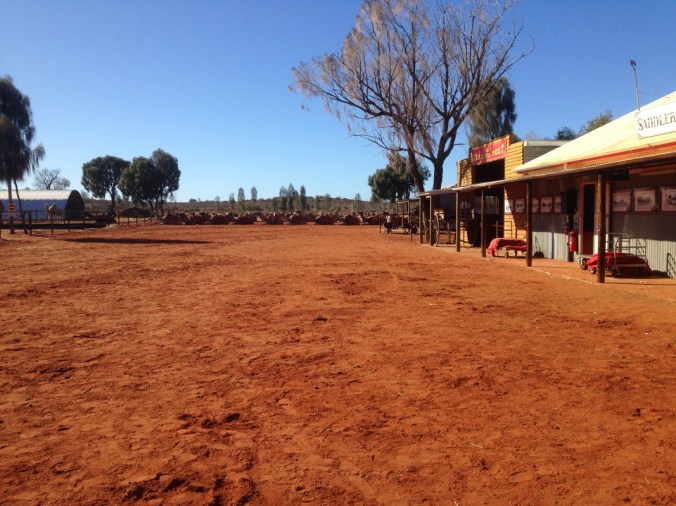 Here’s a few lined up ready to go on some long tours, we were only going to do the 20 minute version.
 Old Tom’s waterhole, not sure who old Tom is. You can see our rig in the car park all packed and ready to head south(home).
 getting up close with our ride! Here we go!
 Time to head towards the Stuart Highway and start our 2,381 kilometre journey home!
 Right it is!
 A far too common sight on the side of the Stuart Highway. Rolled and crashed vehicles, obviously too expensive to retrieve out here, wont be long and they will be scavenged and rusted away in this harsh landscape. Another common sight is road trains, the lifeblood of the outback! Click HERE for some interesting information on road trains.
 A couple more photos of these largish trucks!.
 Not real great fun overtaking them either as you watch the individual trailers moving around!
 We were heading for Marla, 5ookm away in South Australia, our first stop on the way home. When we set up camp behind the Road House we realised there were seven of us instead of the usual six. We had picked up a hitch hiker!
 Poor little fellow, thought he might like a holiday, we caught him and placed him on the side of a tree at Marla much to the disgust of our youngest who thought we could take him home.
 Next morning we continued south to Coober Pedy to have a look at this interesting place, click HERE to find out more about this bizarre place! You know you are getting close when you come across these mounds.
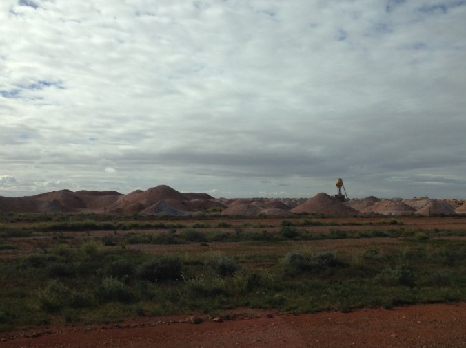 There is some serious mining for Opals here, it is also known as the opal mining capital of the world with over 70 opal fields. To me the unfortunate thing is it leaves the landscape looking like the above and below photo’s, interesting but quite ugly!
 There are a lot of houses here that are mostly underground or partially underground to escape the searing heat experienced here. You can see the ventilation shafts in the photo below.
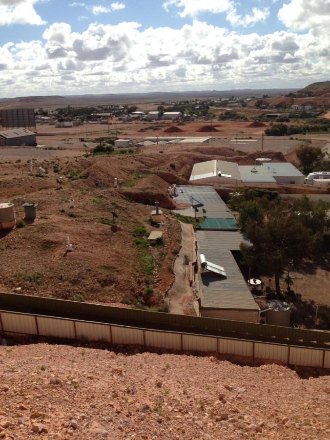 Here’s a panoramic view from the lookout.
 Another view.
 Time to move on. unfortunately we found Coober Pedy to be dirty, unappealing and creepy. Not a glowing endorsement considering plenty of other people find it amazing. I should also say that we didn’t do any of the underground mine tours or building tours, apparently these are quite good. We can recommend the Coober Pedy Outback Bar and Grill, we had a really great lunch! Time to hit the road again and get as far along as we could before it got dark.
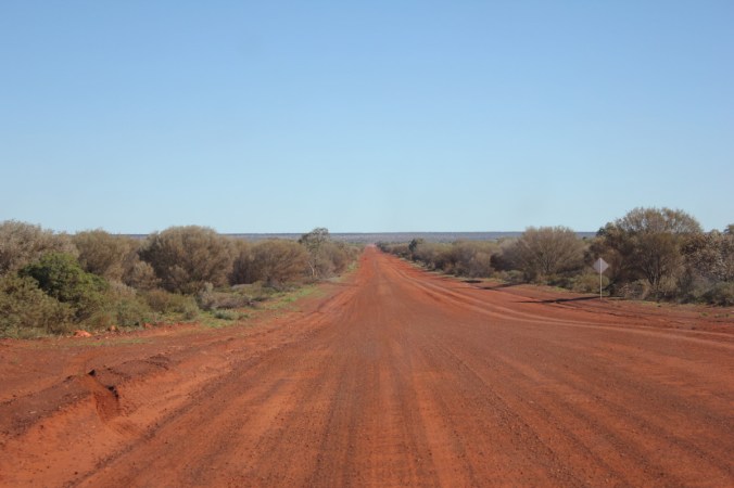
 Another road photo, not really exciting. Lots of road to look at.
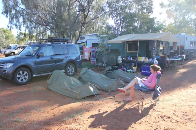
 Last night on the side of the road, plenty of firewood required for a nice warm fire!

 Toasty feet.
 It was a cold windy night. We had one more night before we got home and we decided to book a house at a campground which was sort of nice not to have to unpack and set up the camper trailer, a last night of luxury. Sort of! I apologise for all the blurry/grainy photos above, they were all taken on a IPhone 5a, b or c, who would know…Well after 6500 kilometres and three weeks on the road, it was great to be home with a whole heap of memories and experiences which we shall never forget for all the right reasons! Now the fun starts…..Unpacking!!
 That’s just me with my family poking fun at me, never seemed to have the camera away from my eyes! Oh, and a small bald spot!
Just in case you missed any of my posts on the Northern Territory, here is a recap for you with links to them.
Part 1 – A long time ago now!
 Part 2 – Alice Springs – Olive Pink Botanic Garden

 Part 4 – National Road Transport Hall of Fame.
 Part 5 – Alice Springs Desert Park
 Part 6 – Alice Springs, a few last glimpses.
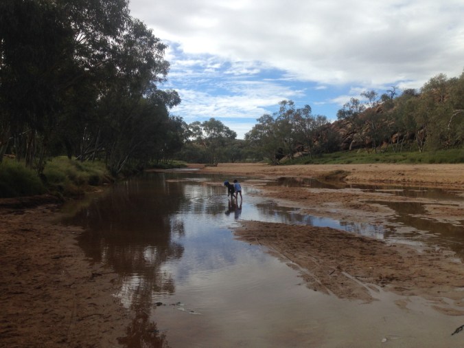 Part 7 – Serpentine Gorge
 Part 8 – Ormiston Gorge and the Ochre Pits
 Part 9 – Kings Canyon
 Part 10 – Kathleen Gorge
 Part 11 – Uluru
 Part 12a – Kata Tjuta – Valley of the Winds
 Part 12b – Kata Tjuta – Walpa Gorge
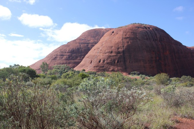 Part 13 – You’re already on it!!
 I will finish here with a tribute to the Northern Territory using lyrics from a hugely popular and loved classic of the screen and Broadway. I couldn’t have said it better!!
And the bells in the steeple too
And up in the nursery an absurd little bird
Is popping out to say, “Cuckoo”
Cuckoo, cuckoo
Regretfully they tell us cuckoo, cuckoo
But firmly they compel us
To say, “Goodbye”, to youSo long, farewell, auf wiedersehen, good night
I hate to go and leave this pretty sightSo long, farewell, auf wiedersehen, adieu
Adieu, adieu, to you and you and youSo long, farewell, au revoir, auf wiedersehen
I’d like to stay and taste my first champagne
So long, farewell, auf wiedersehen, goodbye
I leave and heave a sigh and say “Goodbye”, goodbye
I’m glad to go, I cannot tell a lie
I flit, I float, I fleetly flee, I fly
The sun has gone to bed and so must I
So long, farewell, auf wiedersehen, goodbye
Goodbye, goodbye, goodbye
Goodbye”
 To say it was corrugated and dusty would be a slight understatement to say the least! The first section was an absolute quagmire of corrugations and at a slow speed you felt like you were on some sort of manic rollercoaster, every bump was a shudder of immense proportions. This was going to be great for another 140 kilometres. It did improve though. We decided to see what would happen at a faster speed! Well it was an improvement at a speed of 75-85kmh, mind you it was now a constant smaller shuddering. I can only describe it as a cat the size of an elephant purring beneath your car with the reverberations oozing up into the vehicle and oneself. Everything was just a constant shudder!
 You can see above the dips and creek floodways, these were the worst. As you approached you would slow down to get across them and occasionally some were quite deep with pot holes in them which the front tyres would slam into with a tremendous thump. It all sounds bad but it was an enjoyable experience and the scenery was quite beautiful. Look at the rolling seam of rock in the left side of the photo above.
 There was a couple of classic road signs we saw, both on 44 gallon drums, one before a corner “LIFT UM FOOT” and the other around the corner “PUTTUN BACK DOWN”. I was too slow in getting any shots but click
  In the distance you can see George Gills Range and Kings Canyon is at the right hand end of this range in these photos.
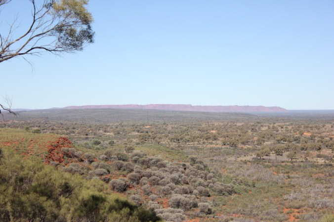 I think the boys enjoyed a chance to stretch and let off some steam, also gave me a chance to quickly check the vehicle and camper trailer were all in one piece. There was a slight problem with the bike rack attachment on the camper trailer, parts of it had come loose and needed replacement, luckily I had spares!
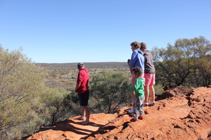 Of course there were plants to admire, check out this pretty Erimophila!
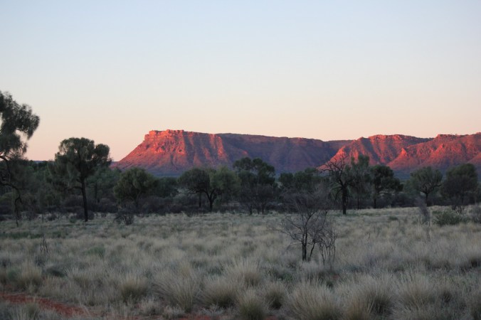
 Cant remember how long it took to complete our journey along the Meerenie loop but we had finally arrive at Kings Canyon. Just in time to set up camp and then watch the suns rays set on the entrance to the canyon.
 The next morning dawned fresh and bright and away we went to get amongst the Canyon. Kings Canyon is part of the Watarrka National Park and sits at the west end of the George Gills Range. The walls in the canyon are over 100 metres high and make for some great panoramic views. Here we go on the rim walk which is highly recommended, give yourself at least 4 hours to truly appreciate this place and watch out for the opening climb, it will test you! Make sure you stop on the way up this straight up climb to admire the views, just don’t let on that you’re puffed!
 Here’s one of my scenic views(puff,puff,puff) lucky there was some plants to look at!
 Above is Tall Mulla Mula also known as Pussytails or scientifically as Ptilotus exaltatus. Below is a Blue Bush. Maireana sp, I’m not sure which one, there are 57 specie endemic to Australia.
 Now that I’ve got my breath back, lets continue up the steep climb!
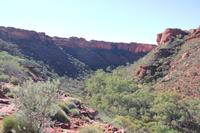
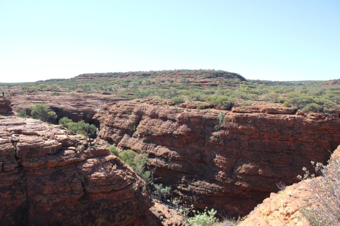
 In the above photo in the middle on the right you can see the car park receding in the distance. Below you can see the canyon walls starting to come into view. The river of green at the bottom is Kings Creek, providing the life blood for those plants.

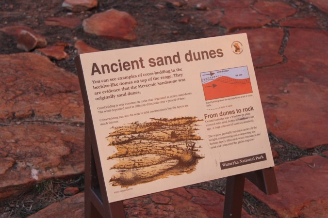
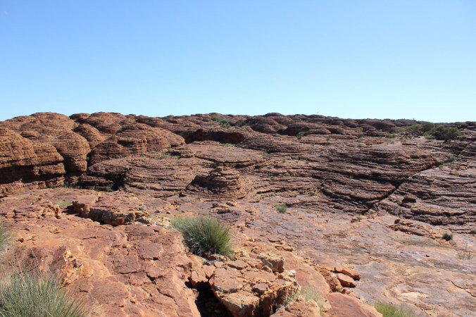
 Picture below is of Sandstone mounds which are quite prolific up on the top of the George Gills Range. They are known as Mereenie Sandstone which has been cross bedded. Basically over time(lots of time) wind has deposited sand in different directions(see description in next photo). The domes you see have been eroded along joint-bounded blocks with rain and wind eroding the corners and sides of the blocks giving us these domed shaped sandstone mounds.
 Looking closely below you will see Rhinoceros Rock. Well that’s what I called it!
 These two photos you can see those Sandstone domes I mentioned earlier.
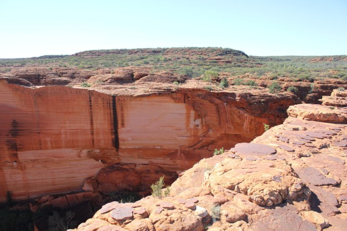
 Now we come to parts where you need to hold your breath as you edge closer to the edge.
 It is a shear drop off the edge there!
 Above we are looking out towards the car park and yes, the views are quite beautiful.
 Yes you are correct, those are people on the opposite side of the canyon looking over the edge! No fences here! Scary!
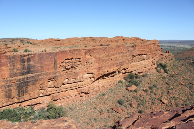
 Not a great photo below but just showing a chasm(Joint) and the cross bedding(layers) in the sandstone.
 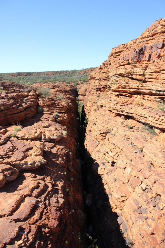 Lets have a look at a few of the plants up here. The Desert Heath Myrtle, Thryptomene maisonneuve were in full flower. These Thryptomenes are widespread throughout arid Australia and can grow to 1.5m high.
 Below is Macrozamia macdonnellii, The Macdonnell Ranges Cycad, interesting to see cycads out in arid country!
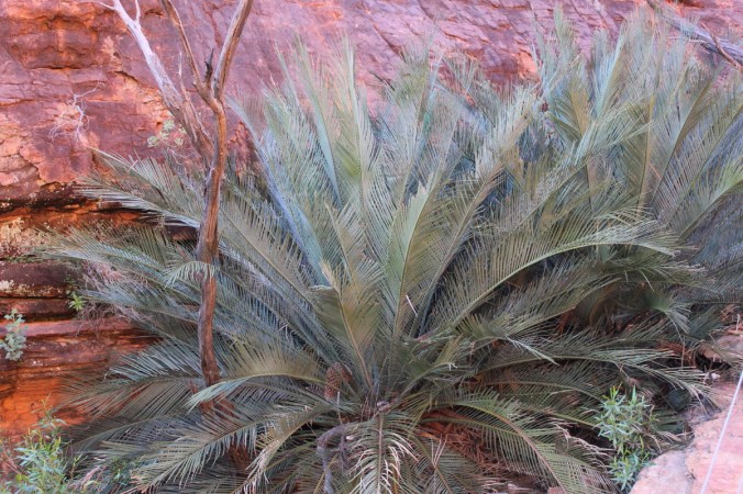 This one below looks like some kind of Hibbertia sp. Also know as Guinea Flowers, pretty nether the less.
 Not sure of this one, obviously situated in the Daisy family, could be a Calotis or a Minuria or some form of Brachycome or I could be totally off the money. Nice flowers though!
 This is Pandorea doratoxylon which we saw at
 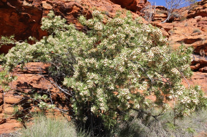 This is the stunning Holly Leaf Grevillea, Grevillea wickhamii.
 A shrub or small tree 1-4m or even 8m tall in places, seen in Western Australia and inland Northern Territory.
 We’ll leave the plants alone for a little while and head back into the scenic elements of Kings Canyon.
 Below we are looking into the Garden of Eden, an oasis in the middle of Kings Canyon fed via Kings Creek which creates a sublime environment in the heart of this arid country.
 Look at the reflection in the water, beautiful!
 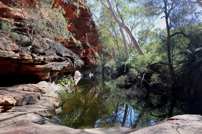 Here is a stand of the Macdonnell Ranges Cycads.
 Check out these reflections! Not Bad!
 The one below is actually taken looking directly into the water!
 Staircase leading out of the Garden of Eden and on towards the rest of the Rim Walk.
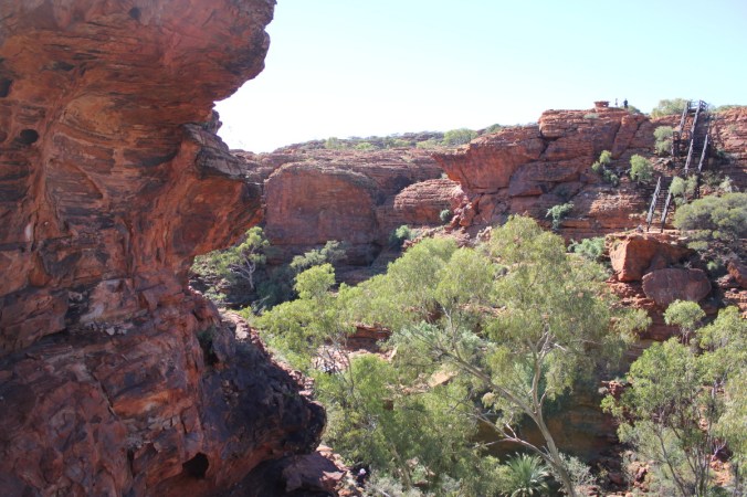 Here we are around the other side of the rim. That edge to the right of those people is a straight drop of about 100m or more and then maybe double that to Kings creek at the bottom, scary stuff!
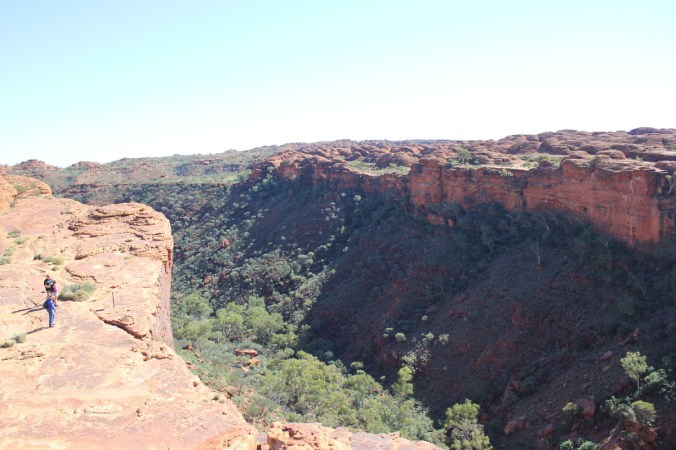
 Wow!
Wow!
 A bit more information above and no we didn’t smash any rocks to check the insides!
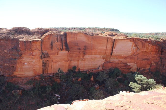 The colours were truly amazing!

 I like this one above, it shows a couple of fault lines running in different directions. We are now on our way back towards ground level and the finish of the Rim Walk, a few more plants have caught my eye! I think this one is either a Goodenia, Lechenaultia or Velleia sp. Pretty little shrub on the sandstone hills on top of the canyon.
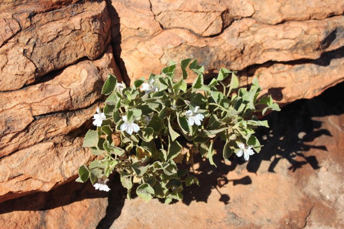 This one below is quite possibly Goodenia cycloptera.
 Plants have an amazing knack of growing anywhere, have a look at this fig below.
 This one below looks like a bit of an oddity and haven’t been able to work it out yet!
 A few more pics of Ptilotus exaltatus.
 Here’s a good photo of one we’ve seen before, Solanum quadriloculatum.
 This is Kestrel Falls, apparently where lots of Kestrel’s roost and also some good waterfalls here during the wet season.
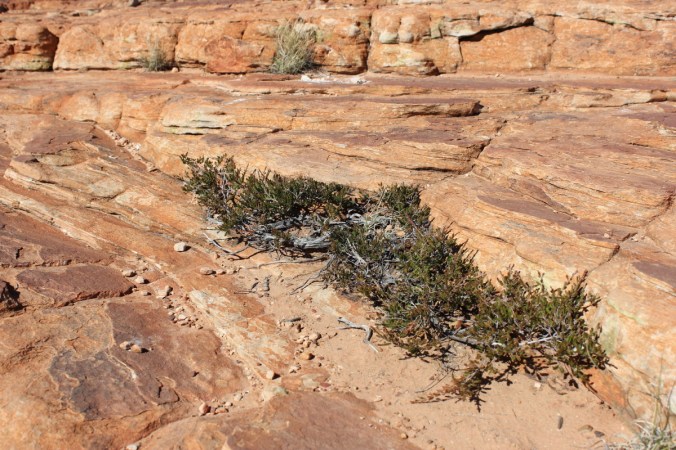
 A few more plant photos showing the tough environment here.


 Cheers!