ULURU
Hi There!
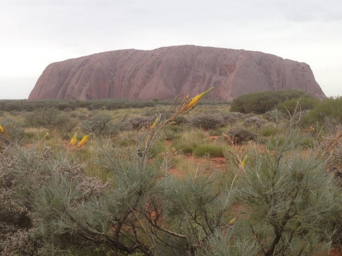
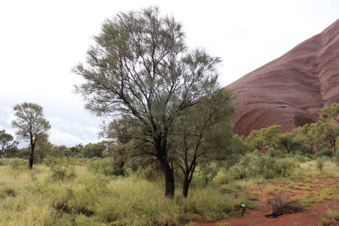
Well we were on our way to Uluru, previously known as Ayres Rock. What would we see? What would we feel? How would we react when we saw the rock? Is this the ultimate destination in Australia? Lots of questions, I know, but relevant I would think. The boys were excited, the other half was excited. Me? Not sure. I wonder what people over the world would think of when prompted about Australia? When questioned would they say yes, we know of the Great Barrier Reef, the Sydney Opera House and yes Kangaroo’s. Malcolm Turnbull? Bob Hawke? Paul Hogan? Sorry! I digress. Would they say, Ayres Rock(Uluru)? I somehow think that yes Uluru would be near or at the top of the list. I think for most of us Australians its a pilgrimage of sorts. Not sure if that’s true or not but most people have either been or want to go and I’m sure there’s some that just couldn’t be bothered. I must admit that as we drew closer to seeing the “Rock” the excitement level was rising. You don’t see much from the road as you approach Yulara(town/resort next to Uluru), but it’s still a “WOW” moment when you catch that first glimpse. Here’s this great monolith of a rock that just protrudes from the surrounding landscape in what is practically the centre of Australia. Yes I know it’s not the geographical centre of Australia, that’s only about 300km away as the crow flies. We did notice four-wheel drive vehicles up on top of the sand dunes getting clear views of the Rock, but we were pressing on to the Yulara and the Ayres Rock Resort-Ayres rock Campground.
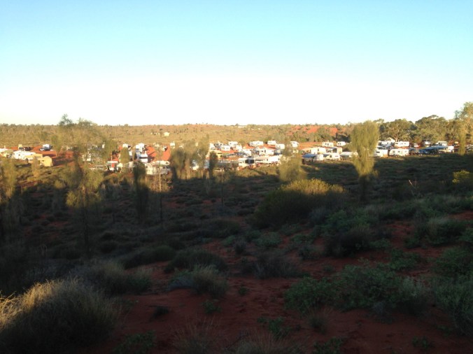
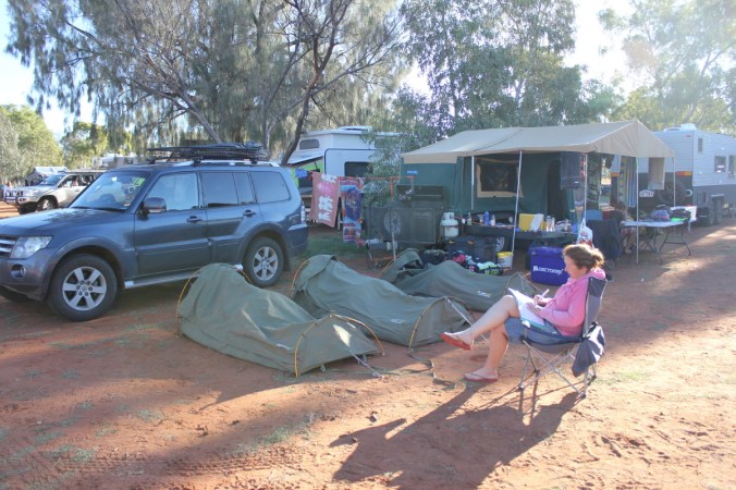
That’s an oxymoron if ever there was one! Resort, ha! Not this campground. Else where maybe if you were paying big bucks at one of the fine and dandy accommodation resorts. You see, we hadn’t booked a campsite. Mind you we had rung about 4 days out but it was fully booked out, great I thought! “Don’t worry” they said, ‘just turn up and you can find a spot in the overflow section and its only $10 dollars a night”. Click, click, mental arithmetic happening, 3 nights, 10 dollars a night, got it, $30 bucks, gee that’s cheap, end of mental arithmetic. They also said get there early in the day to get the best spots(aka-closest spots to the amenities block in the actual campground). We have noticed in the Northern Territory that at the big campgrounds there are queuing up lanes to get in and they are usually full towards the end of the day or even after lunch! So we got there in the early afternoon and a bonus we didn’t have to wait too long and we were in looking for the overflow section. I guarantee you that the overflow section was in the vicinity of 10-20 times bigger than the actual campground and the front section(aka-closest to the amenities block) was virtually full. If you ever want to see what caravans and camper trailers are in use around Australia this would be the place to go! We found a spot amongst some small scrubby plants including Grevillea and set up camp, got the binoculars out to look for the amenities block and discovered them about 600 metres away! Time to set up a shuttle bus to get to the toilet!!
 Not a great picture but this is the Shanty Town-Overflow section or most of it!. Below is the section closest to the amenities on the right which you cant see and we are located in the left of this picture. The Khaki setup on the left at the front. The funny thing is that this overflow virtually empties and fills every day, which is not surprising when you see the amount of travellers on the road! There was also some campers here in this section that obviously were spending a week or two here and they had worked their way to the front of the overflow section therefore being only 40-50 metres away from the amenities. They were also from the Territory and obviously knew about the cheap overflow section.
 The sun was now starting to sink and the park had a sunset viewing area of the rock. So off we trundled with the crowds to have a look. The area was slightly busy, so we worked our way along the dunes until we had our own mostly private viewing area. This is what we saw! At last, Uluru in all its glory.
 Again with different colours.
 A bit later.
 And now no sun. Beautiful!

How is it that Uluru changes colour so much? Well, the answer is quite simple. The colour changes as a result from the effects of the earths atmosphere on the suns incoming rays. Dust, ash and water vapour in the atmosphere act as a filter which can remove the bluer light from the suns rays, allowing redder light through at different times of the day. When the sun is directly overhead, the suns rays only have to pass through a thin atmosphere therefore minimising the filtering effect. Whereas in the mornings or evenings when the sun is low on either horizon, the suns rays have to travel through a thicker layer of atmosphere to reach a certain point on the earths surface. The light reaching Uluru at sunset or sunrise is mainly from the red end of the spectrum and its reflection from the rock and clouds in the sky cause the spectacular colours. The surrounding landscape further enhances these effects.
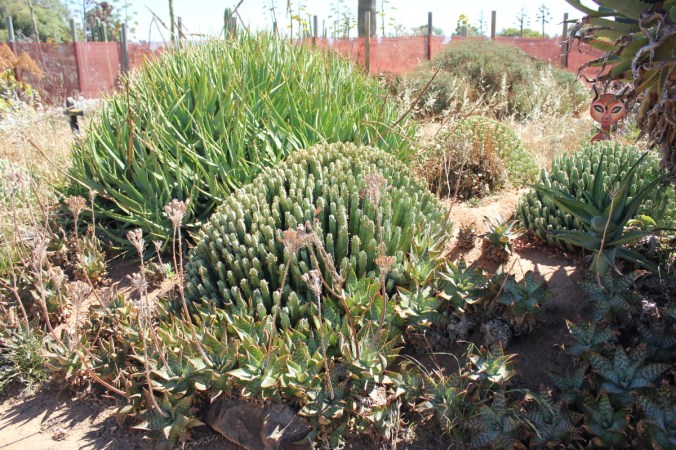
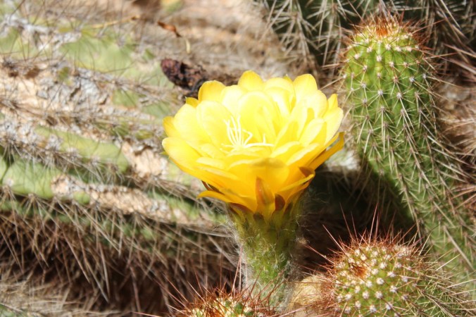
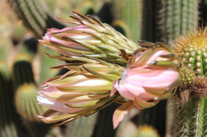
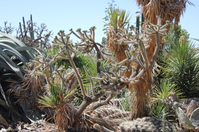
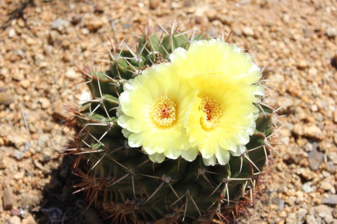
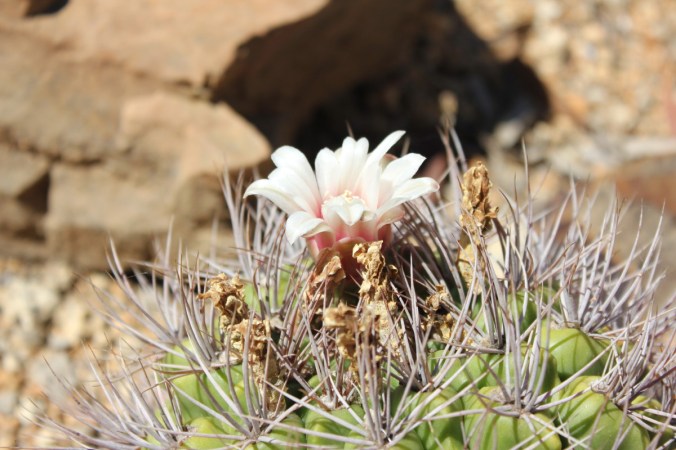
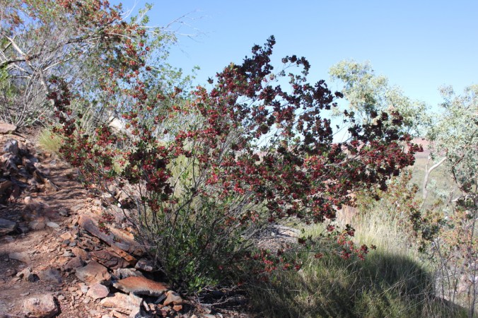
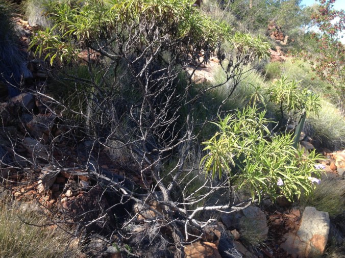
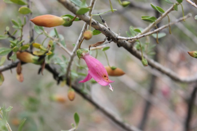
 A peculiar plant caught my eye on these dunes know as Green Bird flower, Crotalaria cunninghamii. This shrub growing between 1 and 3 metres is found in inland areas on red sand dunes. Can be erect or sprawling with velvety stems. Large yellow-green flowers striped with fine black or purple pin strips are present on terminal racemes to 22cm in length during winter and spring.

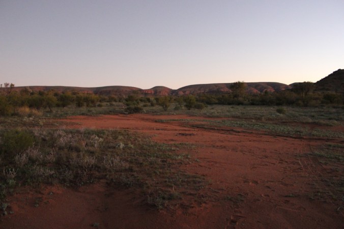
 Time to head back to camp and cook tea. Check out the amazing colour of the dirt(sand really!).
Today was a holiday in the Northern Territory, Territory Day! This is the only day of the year you can buy fireworks and let them off in the Northern Territory!! We had been warned and sure enough well into the night and even early next morning fireworks were going off everywhere at Yulara. What a racket! Could only imagine what it would be like in Alice Springs or even Darwin! The next morning greeted us with drizzly rain and puddles. What a day to visit Uluru, yuck, it wasn’t looking good.
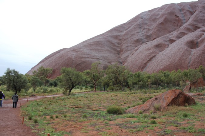
 We made our way to Uluru-Kata Tjuta National Park getting glimpses of a wet rock on the way. It still looked amazing and impressive in the landscape.

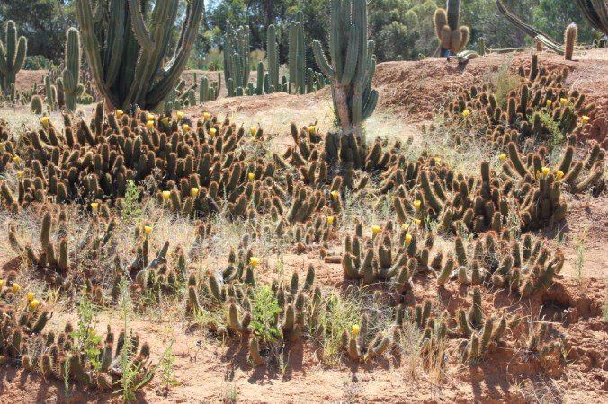
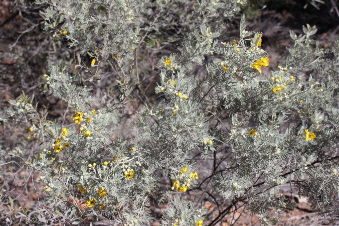
 Here are some Honey Grevillea’s, Grevillea eriostachya, these were everywhere around Uluru, flashes of brilliant yellow amongst a red and green background. Grows to about 3 metres and flowers for a long time in winter and spring. We made our way to the Cultural centre to escape the rain and learn more of Uluru and the Anangu Land which is run by the traditional landowners who are the Yankunyjatjara and Pitjantjatjara people. From the guide-book, “This land was created by the creation ancestors. In their travels they left marks in the land and made laws for us to keep and live by. We hope that during your visit you will learn about some of our ancestors and culture. Please respect this knowledge and open your minds and hearts so you can really appreciate our enduring culture” There were lots of things to see and do in the Cultural Centre. I overheard a tourist asking a Park employee what was worth looking at Uluru during the rain. The response was “do the Mala walk, it has brilliant waterfalls during wet weather”. So off we trundled into the rain to do the Mala Walk. Its only 2km return and flat, so very easy. Our plan had been to cycle around Uluru but the hire company doesn’t operate in the wet. As we had two bikes with us, we needed another 4. That wasn’t going to work, was it! Back to the Mala walk, Mala is Aboriginal for Rufous hare-wallaby. Click HERE to see what it looks like. Could be an overgrown rat crossed with a Hare!! In this section there were sheer vertical cliffs which were impressive.

 It was simply stunning to see Uluru in the rain. It had stopped mostly but the waterfalls were still running albeit slower and smaller. I have since seen photos after and during major deluges on Uluru which show water cascading down everywhere in huge quantities.
 Everywhere you turned to look at Uluru you would see different colours in the rock and this changes as the sun rises and sets on it as well.

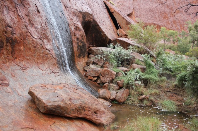
 Cave right at the base of Uluru
 Notice above how the rain has changed the colour of the rock
 What is Uluru composed of? “Uluru is composed of arkose, a coarse-grained sandstone rich in the mineral feldspar. The sandy sediment, which hardened to form this arkose, was eroded from high mountains composed largely of granite” , this is quoted from the online Department of the Environment and Energy. Click HERE if you want to know more of the Geology of Uluru. An interesting piece of information is that Uluru is a visible tip of a huge rock slab that extends possibly 6 kilometres underground! The exposed bit is supposed to be the biggest exposed rock going around, imagine if it was all exposed!!


Waterfalls everywhere!

 Crystal clear water.
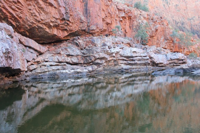
 Beautiful scenery where ever you turned. Below is Kantju Gorge a wonderful location with a lovely waterfall.

Not much to say really, simply enchanting. We then drove around to the sunset/sunrise viewing area which is on the opposite side to the Mala walk and here you get a completely different aspect of Uluru.
 Another view from the sunset/sunrise viewing area.
 The Wattle above is Acacia ligulata, also known as Umbrella Bush, this grows to about 4 metres.
 When you look closely at the surface of Uluru, it looks like its flaking and it is. This is caused by a chemical decay of minerals. The rusty colour of the exposed surface of these flakes is caused by the oxidation (rusting) of the iron in the Arkose. Fresh Arkose is grey in colour. Some more examples below.

 Below is Ptilotus obovatus, a lovely little shrub to about 1 metre high and across has pink flowers frequently after rain. Often seen on shallow stony ground. The leaves are covered with star-shaped hairs giving the plant a silvery appearance. I saw this one on the Kuniya Walk, which is an easy walk to the Mutijulu Waterhole home of Wanampi, an ancestral water snake.
 Closeup of Ptilotus flowers
 Here is the Mutitjula Waterhole, another special place at Uluru.
 The photo below in some way summed up Uluru for us. The comment was made something along the lines of “look its breathing” or something of that effect. Well! It did sort of feel alive, maybe it was just the flow of Arkose Sandstone and how it was shaped or how the rain ran off it, maybe its cultural significance, even its history over time or maybe all of the previous combined. It just felt significant. I can now understand why the traditional owners revere it. This is a special place.
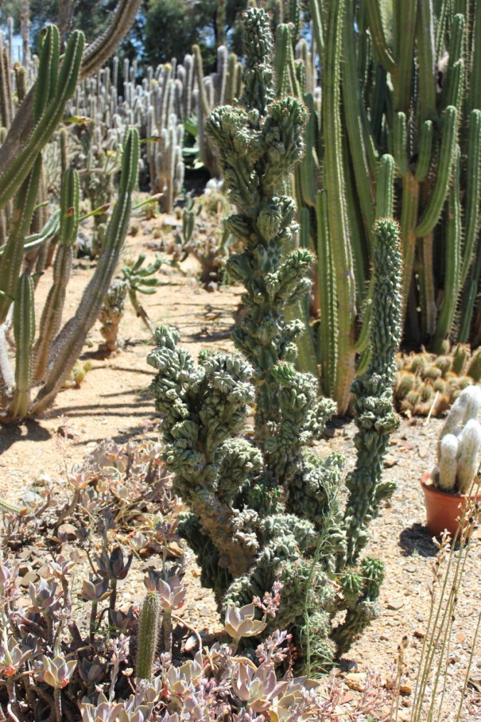
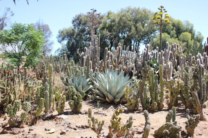
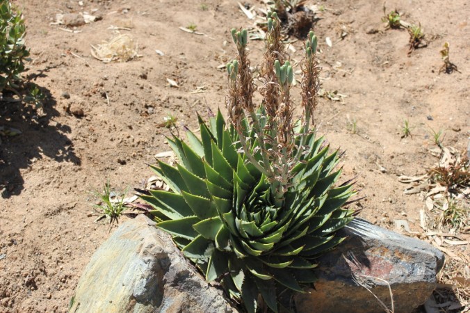
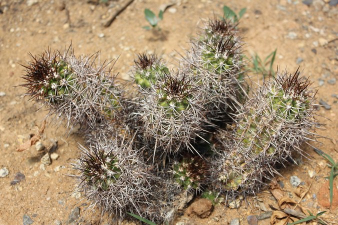
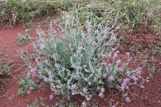
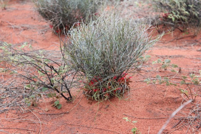
 Here’s a few more plants I noticed on our travels around Uluru.
 This is Upside down plant, Leptosema chambersii. Obviously you can see how it got its common name. It’s a bit topsy turvy with the flowers at the bottom. A small shrub with leaves reduced to scales. Lives on sand plains and dunes normally with Triodia sp. Closeup below.


Another interesting plant was Bush Plum, Santalum lanceolatum, it grows to about 7 metres as a shrub or small tree on a wide variety of habitats and flowers throughout the year. Fruit is usually eaten straight from the tree, older branches are also harvested for sandlewood.

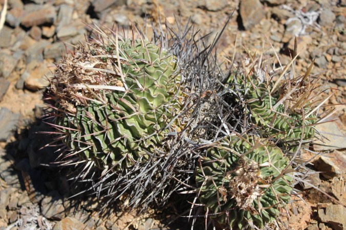
 This one below is one of the Triodia species, usually quite a sharp and prickly clumping grass
 The large trees around Uluru were Desert Bloodwood, also known as Corymbia terminalis .
 There were also a large Grevillea called Beefwood. Grevillea striata.
Well the day was coming to an end and we hadn’t done everything we wanted to due to the weather and consideration for children. We were damp, tired and pretty chuffed that we had finally made it to this legend of our great southern land, Uluru, a monolithic breathing living monstrous rock.


Finally, a last parting glance for this day at this magical place known as Uluru.
 Cheers!
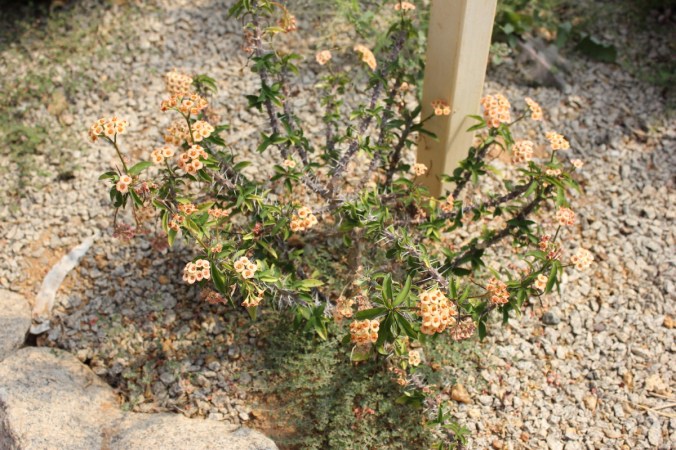
 Below is quite a bizarre looking plant called the Orange Spade Flower, Hybanthus aurantiacus . This is a small erect shrub to about 40cm and quite widespread although I only saw it in a couple of places. The flowers have five petals, four very small ones and one large one shaped like a shovel!!
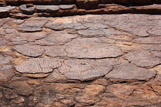
 Here’s some more sea ripples, although the indigenous people have a slightly different story about these ripples.
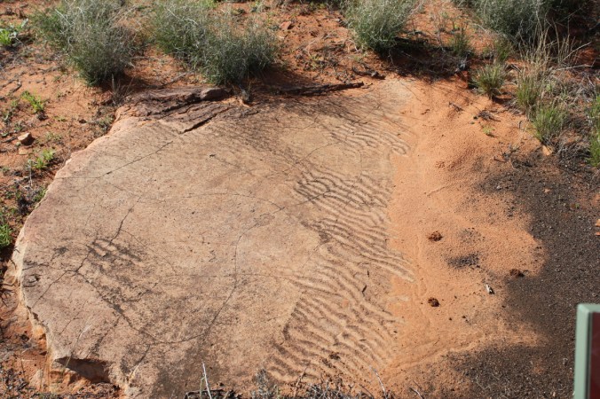 If you remember in Part 9, we saw some of these ripples on the Rim Walk at Kings Canyon. See below for a different take on these!
 I don’t particularly want to meet Inturrkunya!!
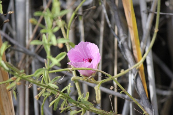
 Golden Orb Spider with its young, we get these at home as well although this one was massive! Below we have Hibiscus leptocladys also known as the Variable Leaf Hibiscus.

 Another piece of rock…
 This is Abutilon leucopetalum, also known as Lantern Bush, grows to about 1m or less.
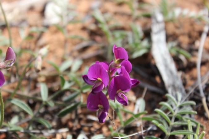
 This one I think is Swainsona flavicarinata, Known as Swainsona or Yellow Keeled Swainsona. This is a prostrate herb.
 More rock!
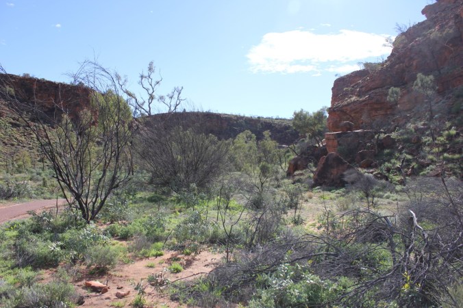 This one is quite possibly Indigofera basedowii, a perennial shrub to 1 metre with grey-pubescent foliage with inflorescences to 11cm long.
 Here’s a close-up of the flowers
 Some more plants
 A small creek
 This one is Senecio gregorii , alson known as Annual Yellowtop, grows to 40cm high and is an annual. Widespread throughout all states.
 This is Scaevola parvibarbata a perennial growing to about 50cm, widespread on sandy areas.
 So there you have it, a short interlude at Kathleen Springs on our way to another great destination in the Northern Territory!
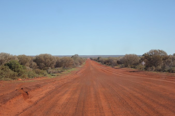
 To say it was corrugated and dusty would be a slight understatement to say the least! The first section was an absolute quagmire of corrugations and at a slow speed you felt like you were on some sort of manic rollercoaster, every bump was a shudder of immense proportions. This was going to be great for another 140 kilometres. It did improve though. We decided to see what would happen at a faster speed! Well it was an improvement at a speed of 75-85kmh, mind you it was now a constant smaller shuddering. I can only describe it as a cat the size of an elephant purring beneath your car with the reverberations oozing up into the vehicle and oneself. Everything was just a constant shudder!
 You can see above the dips and creek floodways, these were the worst. As you approached you would slow down to get across them and occasionally some were quite deep with pot holes in them which the front tyres would slam into with a tremendous thump. It all sounds bad but it was an enjoyable experience and the scenery was quite beautiful. Look at the rolling seam of rock in the left side of the photo above.
 There was a couple of classic road signs we saw, both on 44 gallon drums, one before a corner “LIFT UM FOOT” and the other around the corner “PUTTUN BACK DOWN”. I was too slow in getting any shots but click
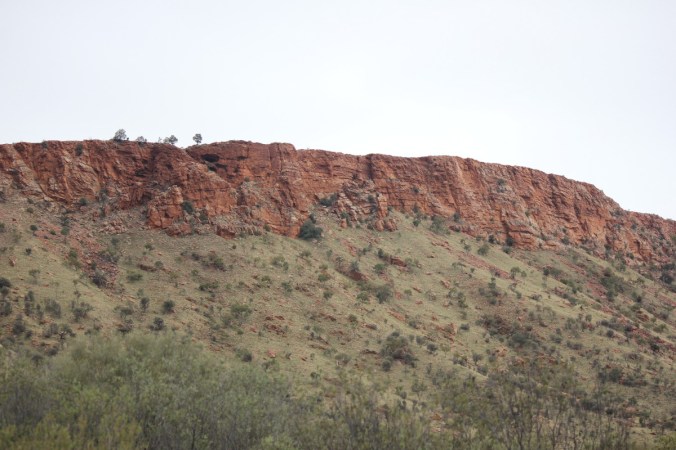
 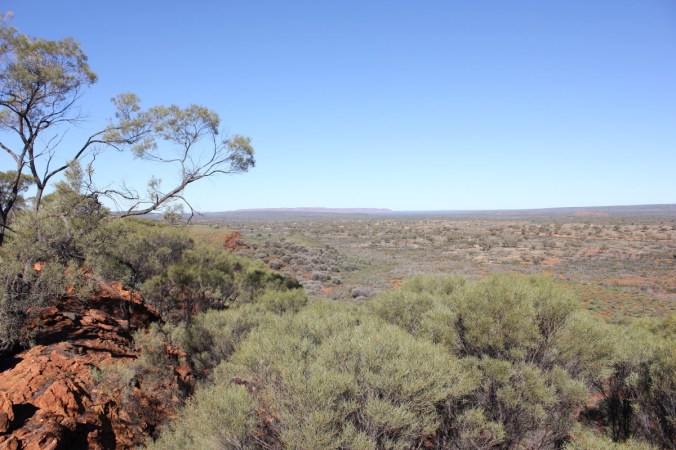 In the distance you can see George Gills Range and Kings Canyon is at the right hand end of this range in these photos.
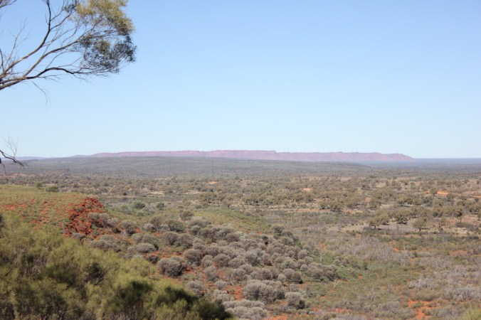 I think the boys enjoyed a chance to stretch and let off some steam, also gave me a chance to quickly check the vehicle and camper trailer were all in one piece. There was a slight problem with the bike rack attachment on the camper trailer, parts of it had come loose and needed replacement, luckily I had spares!
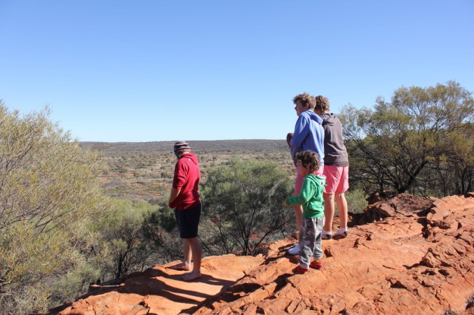 Of course there were plants to admire, check out this pretty Erimophila!
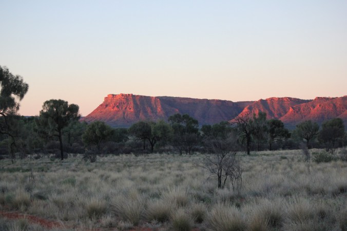
 Cant remember how long it took to complete our journey along the Meerenie loop but we had finally arrive at Kings Canyon. Just in time to set up camp and then watch the suns rays set on the entrance to the canyon.
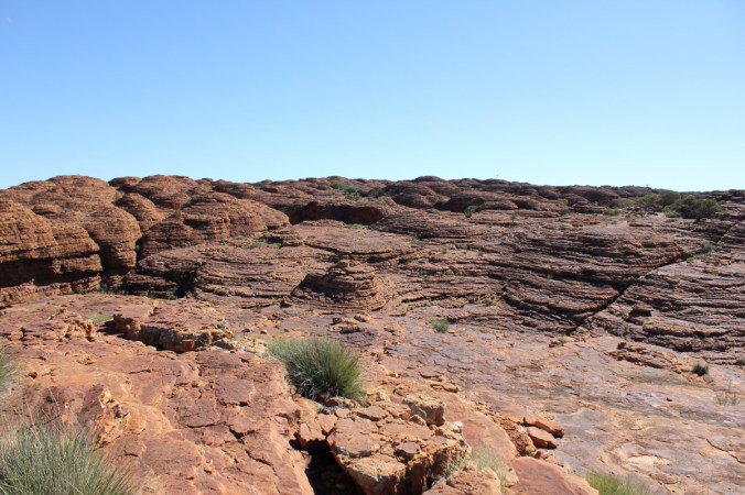
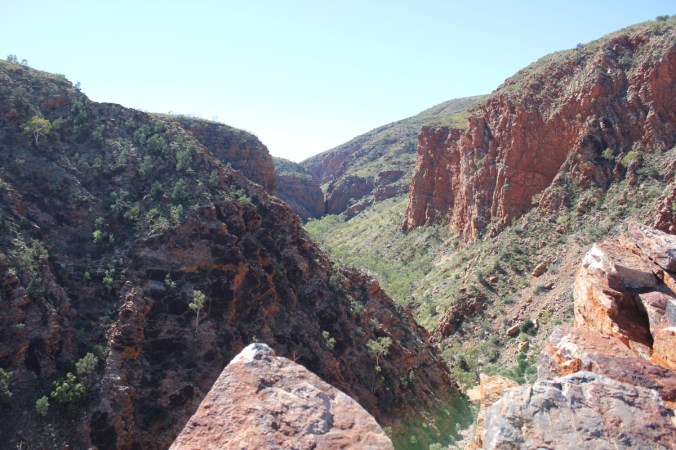
 The next morning dawned fresh and bright and away we went to get amongst the Canyon. Kings Canyon is part of the Watarrka National Park and sits at the west end of the George Gills Range. The walls in the canyon are over 100 metres high and make for some great panoramic views. Here we go on the rim walk which is highly recommended, give yourself at least 4 hours to truly appreciate this place and watch out for the opening climb, it will test you! Make sure you stop on the way up this straight up climb to admire the views, just don’t let on that you’re puffed!
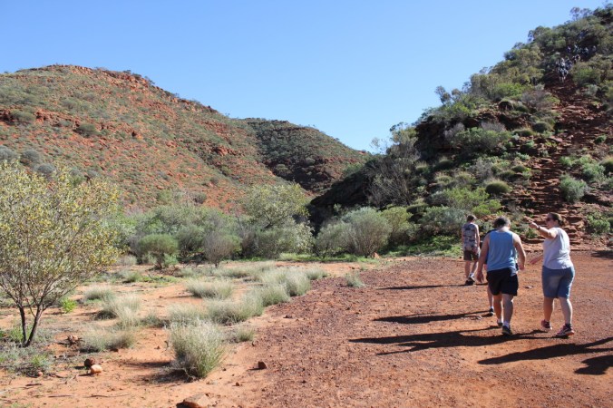 Here’s one of my scenic views(puff,puff,puff) lucky there was some plants to look at!
 Above is Tall Mulla Mula also known as Pussytails or scientifically as Ptilotus exaltatus. Below is a Blue Bush. Maireana sp, I’m not sure which one, there are 57 specie endemic to Australia.
 Now that I’ve got my breath back, lets continue up the steep climb!
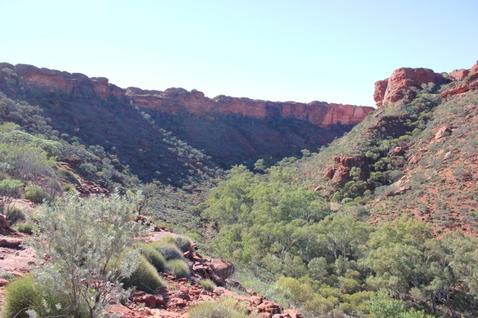
 In the above photo in the middle on the right you can see the car park receding in the distance. Below you can see the canyon walls starting to come into view. The river of green at the bottom is Kings Creek, providing the life blood for those plants.

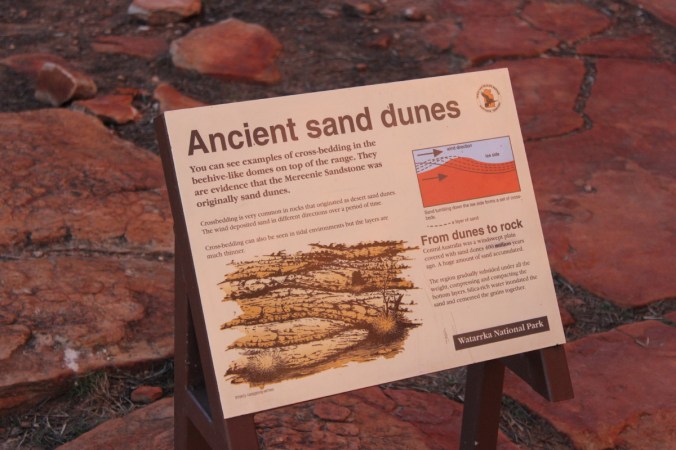
 Picture below is of Sandstone mounds which are quite prolific up on the top of the George Gills Range. They are known as Mereenie Sandstone which has been cross bedded. Basically over time(lots of time) wind has deposited sand in different directions(see description in next photo). The domes you see have been eroded along joint-bounded blocks with rain and wind eroding the corners and sides of the blocks giving us these domed shaped sandstone mounds.
 Looking closely below you will see Rhinoceros Rock. Well that’s what I called it!
 These two photos you can see those Sandstone domes I mentioned earlier.
 Now we come to parts where you need to hold your breath as you edge closer to the edge.
 It is a shear drop off the edge there!
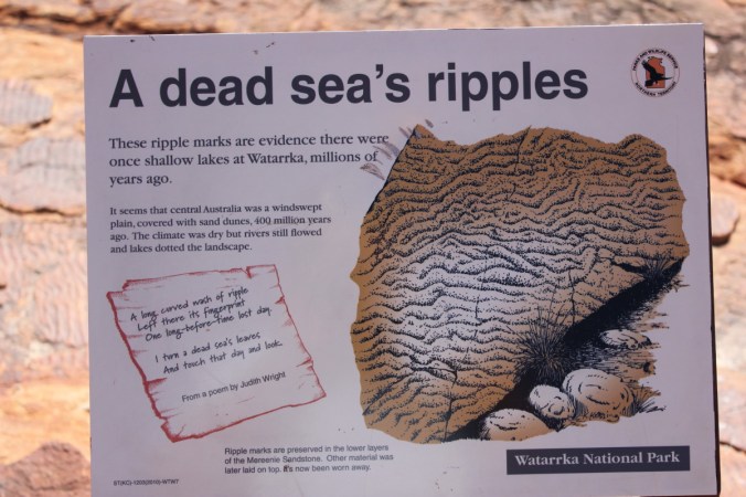
 Above we are looking out towards the car park and yes, the views are quite beautiful.
 Yes you are correct, those are people on the opposite side of the canyon looking over the edge! No fences here! Scary!
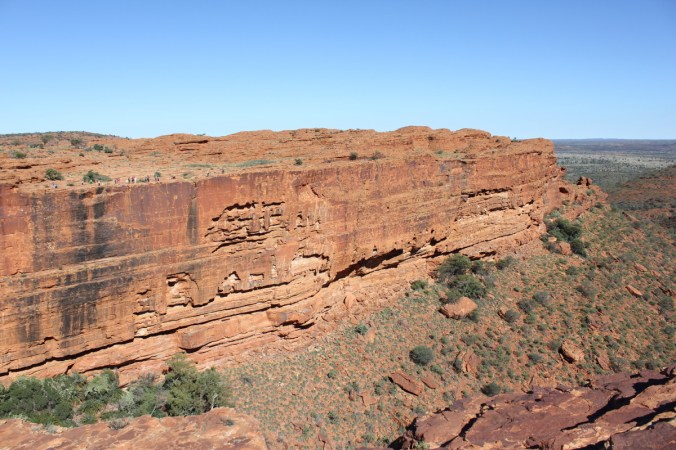
 Not a great photo below but just showing a chasm(Joint) and the cross bedding(layers) in the sandstone.
 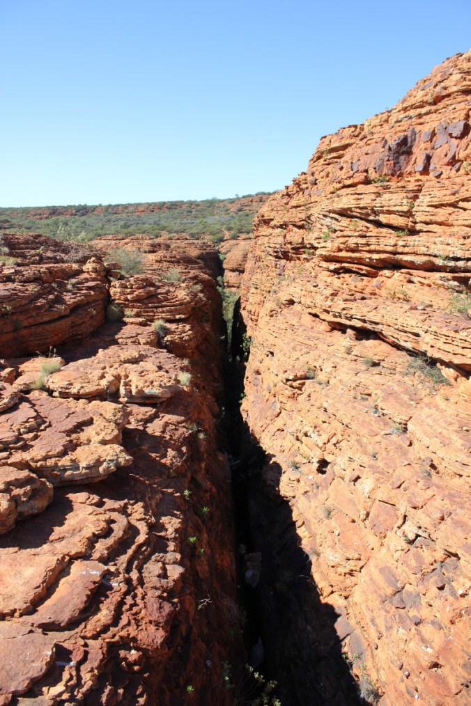 Lets have a look at a few of the plants up here. The Desert Heath Myrtle, Thryptomene maisonneuve were in full flower. These Thryptomenes are widespread throughout arid Australia and can grow to 1.5m high.
 Below is Macrozamia macdonnellii, The Macdonnell Ranges Cycad, interesting to see cycads out in arid country!
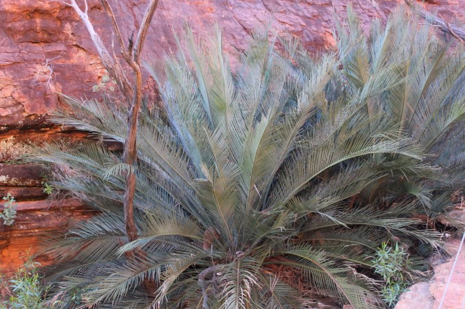 This one below looks like some kind of Hibbertia sp. Also know as Guinea Flowers, pretty nether the less.
 Not sure of this one, obviously situated in the Daisy family, could be a Calotis or a Minuria or some form of Brachycome or I could be totally off the money. Nice flowers though!
 This is Pandorea doratoxylon which we saw at
 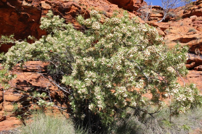 This is the stunning Holly Leaf Grevillea, Grevillea wickhamii.
 A shrub or small tree 1-4m or even 8m tall in places, seen in Western Australia and inland Northern Territory.
 We’ll leave the plants alone for a little while and head back into the scenic elements of Kings Canyon.
 Below we are looking into the Garden of Eden, an oasis in the middle of Kings Canyon fed via Kings Creek which creates a sublime environment in the heart of this arid country.
 Look at the reflection in the water, beautiful!
 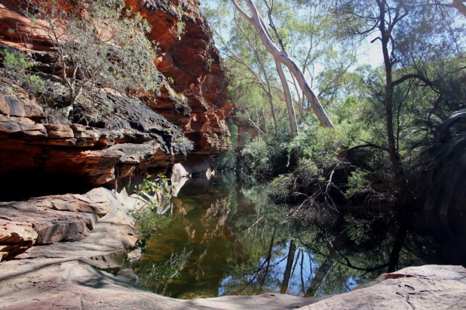 Here is a stand of the Macdonnell Ranges Cycads.
 Check out these reflections! Not Bad!
 The one below is actually taken looking directly into the water!
 Staircase leading out of the Garden of Eden and on towards the rest of the Rim Walk.
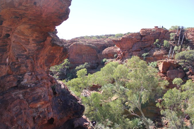 Here we are around the other side of the rim. That edge to the right of those people is a straight drop of about 100m or more and then maybe double that to Kings creek at the bottom, scary stuff!
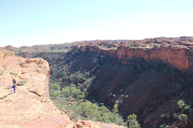
 On this Sandstone cliff you can see the horizontal layers that have been laid down over time.
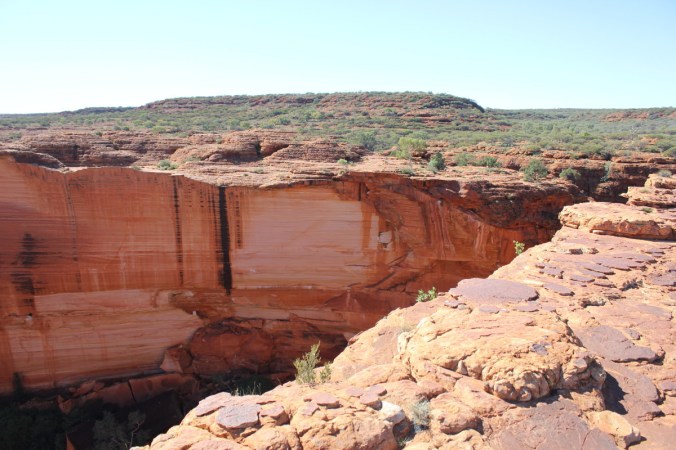 Wow!
Wow!
 A bit more information above and no we didn’t smash any rocks to check the insides!
 The colours were truly amazing!
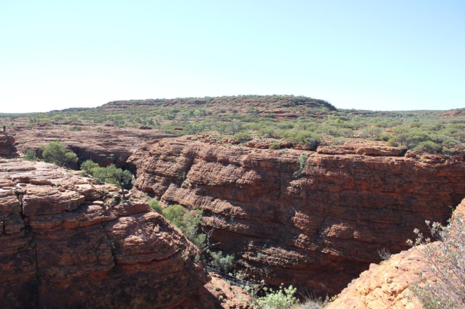

 I like this one above, it shows a couple of fault lines running in different directions. We are now on our way back towards ground level and the finish of the Rim Walk, a few more plants have caught my eye! I think this one is either a Goodenia, Lechenaultia or Velleia sp. Pretty little shrub on the sandstone hills on top of the canyon.
 This one below is quite possibly Goodenia cycloptera.
 Plants have an amazing knack of growing anywhere, have a look at this fig below.
 This one below looks like a bit of an oddity and haven’t been able to work it out yet!
 A few more pics of Ptilotus exaltatus.
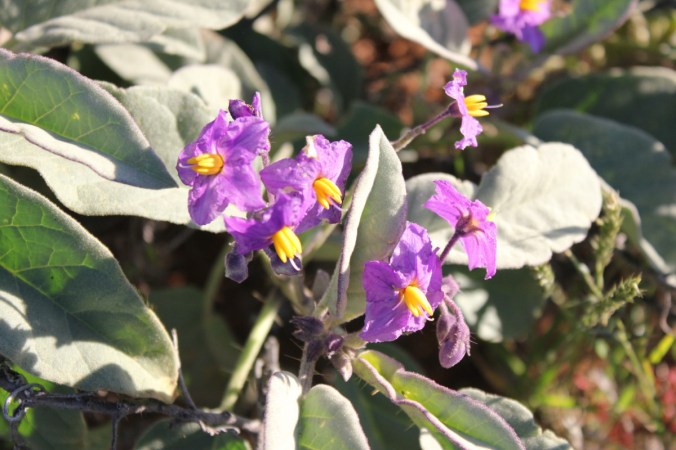
 Here’s a good photo of one we’ve seen before, Solanum quadriloculatum.
 This is Kestrel Falls, apparently where lots of Kestrel’s roost and also some good waterfalls here during the wet season.
 A few more plant photos showing the tough environment here.


 Cheers!
 Layers upon layers of different coloured rock, it was quite stunning and one could imagine the shifts in colour during the day and the seasons.
 Above is some plant trying to cling on in a very harsh environment. Some views below of the creek bed that runs through here.


 The colours were even evident in the creek bed, see below.
 Here we can see where it has been mined.
 Another colourful photo! Or two or three!

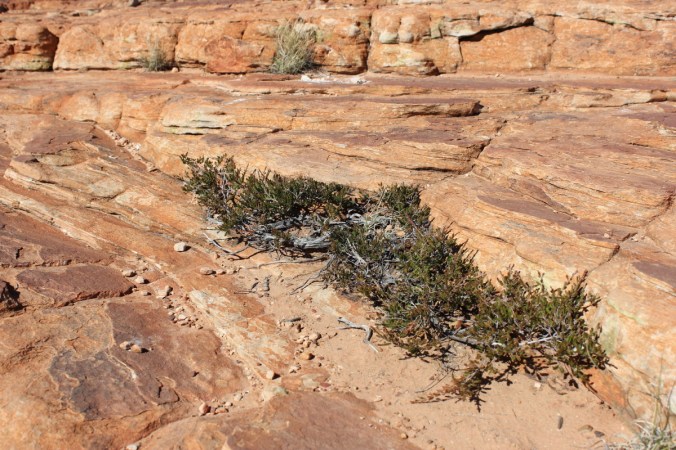
 There’s no point stopping somewhere without checking out the plant life!
 Back in the Pajero and another 17 km’s and we have now arrived at Ormiston Gorge. We had hoped to camp here but the small camp ground was chock-a-block and the sun was on the way down, so we knew we had limited time here which was a shame. Another beautiful Gorge here in the West Macdonnell Ranges on a similar vein to Serpentine Gorge but quite possibly even prettier!
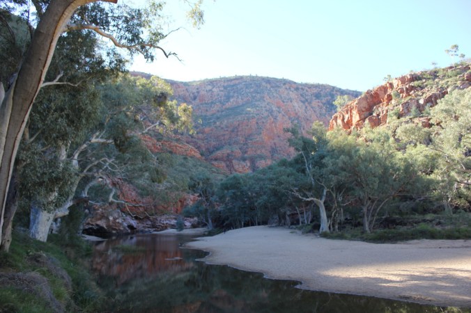 Perfect spot for a swim during the heat of the day, alas it was winter time! Some intriguing rock colour and formations below.

 Of course the plant life here took up some of my time, below is the Long Leafed Corkwood, Hakea suberea , quite common in dry desert regions. This is a large shrub or small tree 3-8m in height with dark brown cork like bark. Beautiful flowers produced in winter-spring, 4-15cm in length.
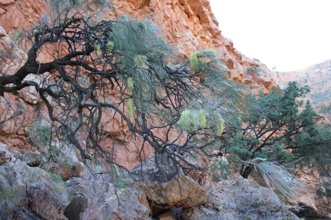 See above the contorted and gnarly branches and the beautiful flowers below.
 Another interesting plant was Wahlenbergia communis , the Tufted Blue Bell growing to 75cm on alluvial plains and intermittent watercourses plus run off area’s, often found in sandy soils as well. A wide-spread perennial in all mainland states.
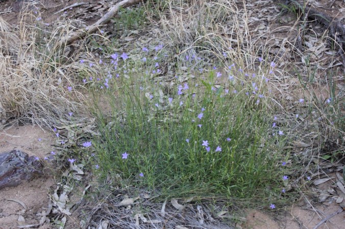 Not a great photo below but a close-up nether the less.
 Here’s some more rugged cliffs.

 Did you notice the gum tree’s growing on the sides of these cliffs, not many but a few hanging on for dear life!
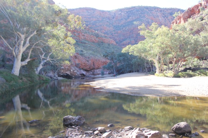 Or even these views…


 Below is looking across the valley
 Time to get set up before the sun disappears!
 Swags, fire and Tea!
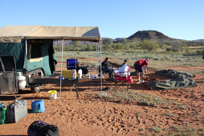
 Now for a bit of exploring! That means plant hunting really!


 Plus a couple of close-ups of the flowers, sort of!


 This is what a lot of the surrounding plant scape looks like, uninspiring you may say but you just need to look closely to find its beauty.
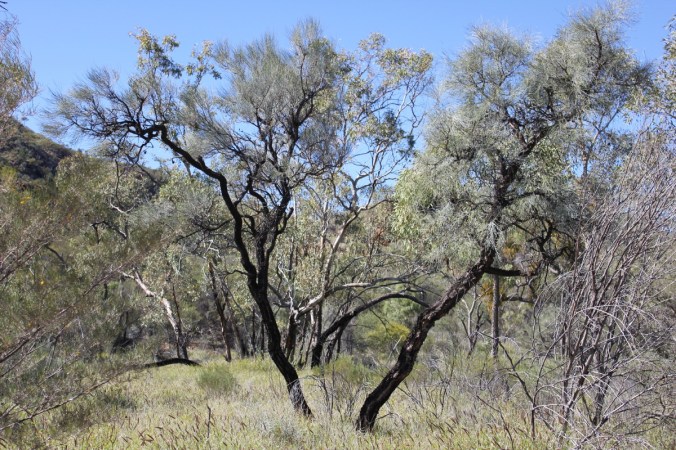 Larapinta trail marker, this walking trail is 223km in length across the Macdonnell ranges, click on this
 Remember! Don’t just look ahead, cast your eye’s down and to the sides of where you’re walking, you’ll never know what you will find or see next.

 Below is Senna artemisoides subsp. artemisoides, another mouthful but a very beautiful shrub which grows to about 1-2 metres with beautiful yellow buttercup flowers in winter and spring.
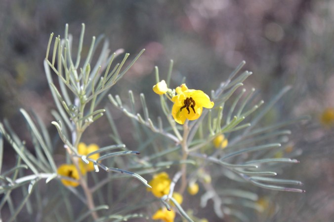
 Maybe you can just call it the Silver Cassia. Now for an Emu Bush. Eremophila latrobei , commonly known as the Crimson Turkeybush, click
 Another stunning Emu bush is Eremophila longifolia , also known as Berrigan, tall shrub to small tree weeping in form, click
  Sorry, I got distracted with the plants in the Serpentine Gorge, lets move onto the scenery. This is the first sort of glimpse of the gorge and it looks like its sort of straight up to the top, hmm!
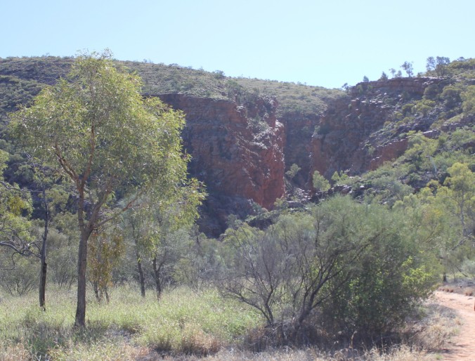 Lets go for it! Now we are starting the climb up and here you can clearly see the parallel ridge lines that run through the Macdonnell Ranges.
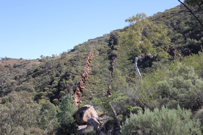 Another couple of views of those ridge lines
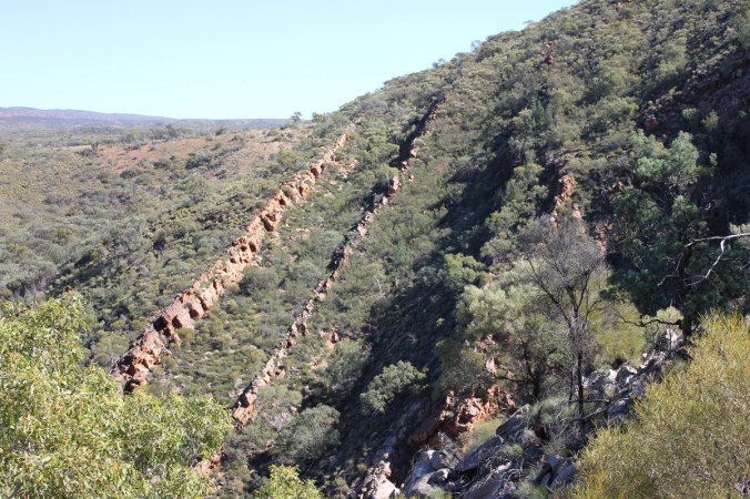
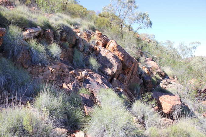
 Yes, as you can see above we are getting higher, quite spectacular! It is quite a rocky landscape and on these hillsides there is a lot of Porcupine grass, Trioda irritans. The last past of its botanic name sums it up very well indeed, very irritating because it’s quite prickly.
 Below are more views across the valley.
 Another plant of interest for me to see in the wild was Dodonaea viscosa , the Broad leaf Hop Bush or just plain Hop Bush, very common in gardens around the country and useful for many things from hedging to specimen plantings. It’s a very variable plant in the wild and widespread across the country.
 Now I know photos are great but there’s just no comparison to actually being there and seeing this landscape. I have a great digital SLR camera but it doesn’t capture the WOW! The size, scope and detail of what your eyes are looking at or what your feeling right then and there as you look at this amazing country. Below is the Serpentine Gorge.

 Where does one go now from these heights? Down one would expect and lo and behold something I missed on the way up nearly hit me fair and square in the head on the way down.
 Leaning over the rocky pathway was this intriguing large shrub with what looked like stems twining around themselves like a climbing plant. This is Pandorea doratoxylon also known as the Spearwood Vine. The Aboriginal people use this plant for spears hence its common name. The long twining stems are light weight and are straightened and hardened over a fire. The flowers are quite pretty when one comes upon them in such a tough landscape.
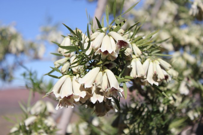 If they look familiar to you, you may be thinking of Pandorea jasminoides the Wonga Wonga vine or also known as the Bower Vine or one of the many hybrids available today. You would be correct because they are in the same family Bignoniaceae. Check out this closeup below!
 This next photo doesn’t show too much, I just liked the detail of the bark. To me it tells a story of the harsh landscape in which it resides.
 These next photos show an interesting Grevillea, the Holly Leaf Grevillea, Grevillea wickhamii. There are a few sub species but I’m not sure which one this is. I have pictures of this flowering at a different location which will be revealed at a later date!
 You can see above that the new growth gives the plant a tinge of yellow which from a distance look like flowers.
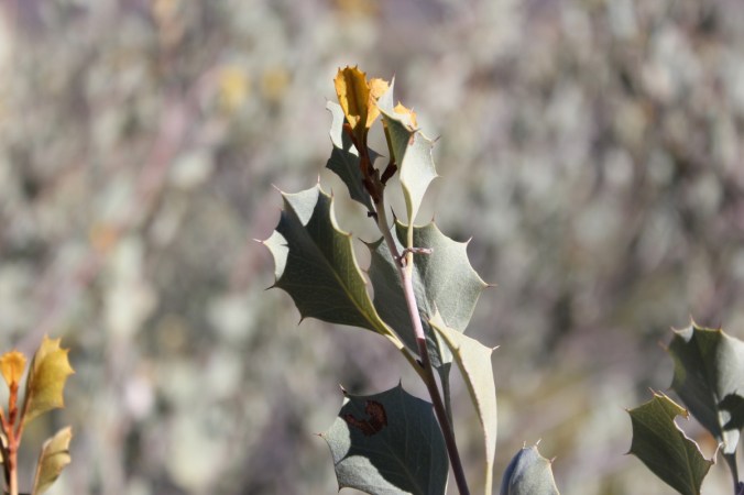 Some more plants of interest here included another beautiful Emu Bush, Eremophila freelingii. The Rock Fuchsia Bush.
 A characteristic of this plant is that it sheds its lower leaves during drought to conserve moisture, you can see that quite clearly in the above photo, the plant looks half dead but it’s not! Grows to about 1.5 metres. The lilac flowers are stunning and are produced after it rains. Just a few more views below of this beautiful plant on the sides of Serpentine Gorge.

 Funnily enough another surprise was what looked to be some type of Fern here as well and yes it was. Not sure of its identity but quite possibly Cheilanthes brownie , The Northern Rock Fern, either way still remarkable to me to see a fern out here. Nature is amazing.
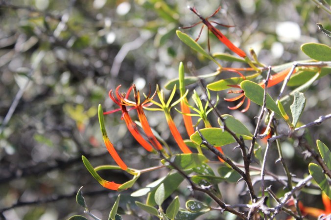
 Another interesting plant we saw was a parasite. Lysiana exocarpi , the Harlequin Mistletoe. This parasite is found mostly in inland locations and is very colourful.
 Now we have made it back down and headed into the cool of the gorge, being winter it wasn’t hot out in the open so one could imagine how nice and cool it would be in the heat of summer.
 In the above photo in the distance you can see some cycads, Macrozamia macdonnellii , the Macdonnell Ranges Cycad. Here they are below as well.
 Ah well! That’s about it for the Serpentine Gorge, here’s a few last photos of plants and foliage.


 Finally a last look into the gorge.
 Cheers!
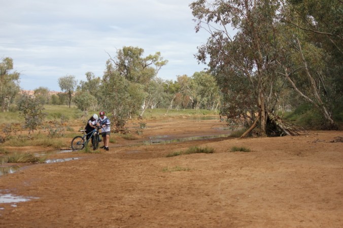
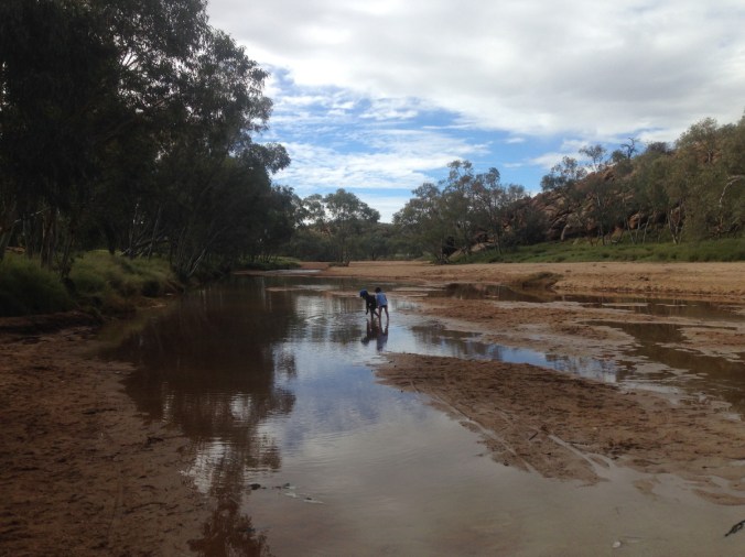
 Yes it is empty, this is only some puddles that are not moving.
 Some of the kids having a ball in the puddles.

 Here’s the dingo stalking a galah…..

 Missed it.. ah well, there’s always next time.


 Well maybe just a smidgen of water. The parting shot of Alice Springs for this post is from Anzac Hill. A memorial to the
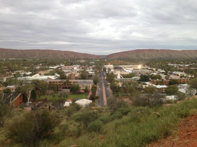

 Thanks “ALICE” it was a blast!!
 Of course there were all sorts of snakes and lizards, sorry about the blurry picture but I just had to include this nasty looking fellow!
 The Thorny devils are always great to watch, these fellows were standing there and eating the ants as they went past them. Their tongues would just flick out and snaffle them up.


 As you can see they are certainly thorny, also very well camouflaged for the desert environment. The Lizard below is just hanging out, I don’t know his name.
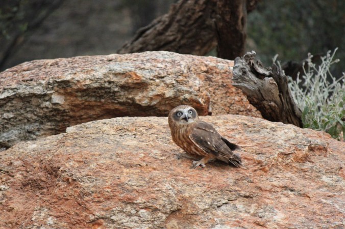
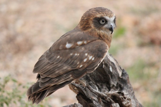
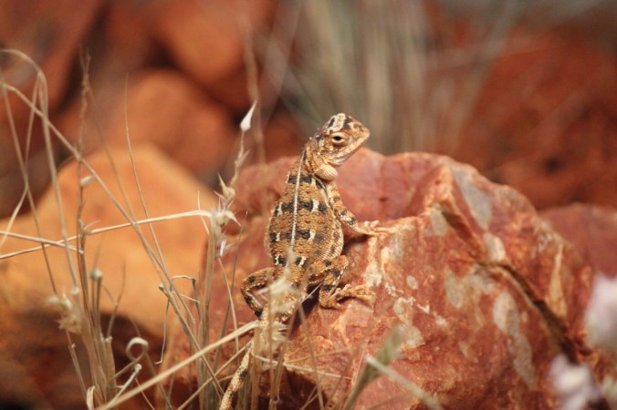 What I noticed a lot of in the park were lots of different Erimophila shrubs. There are about 260 Erimophila species endemic to Australia, also known as Emu Bushes. There are also many cultivars available in nurseries now. Here’s a few from the Desert Park.


 If I say Dingo, what is the first thing that pops into your mind? If you come from Australia like me, I would haphazard a guess that the name
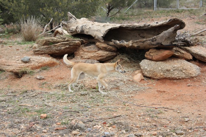
 They blend in quite beautifully with their surroundings as you can see. They also come with different coat colours depending on what habitat they live in. Interesting!
 Here’s another plant that’s prominent in the Alice Springs area Senna artemisiodes subsp. oligophylla, also known as Oval Leaf Cassia. A beautiful yellow flowering shrub to 2 metres.
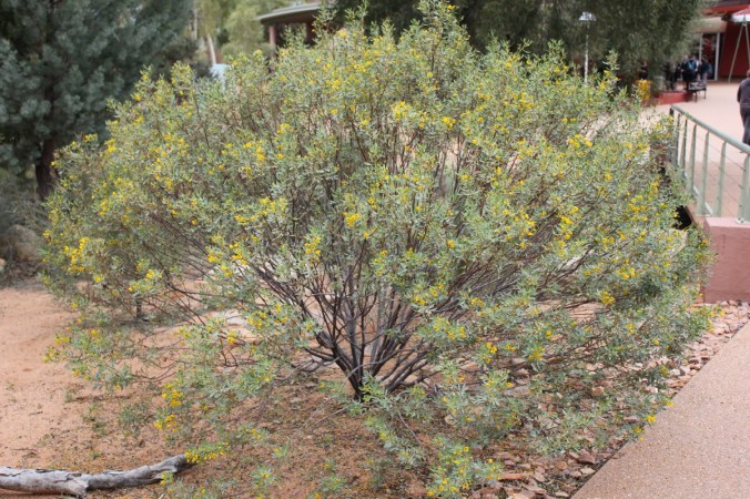

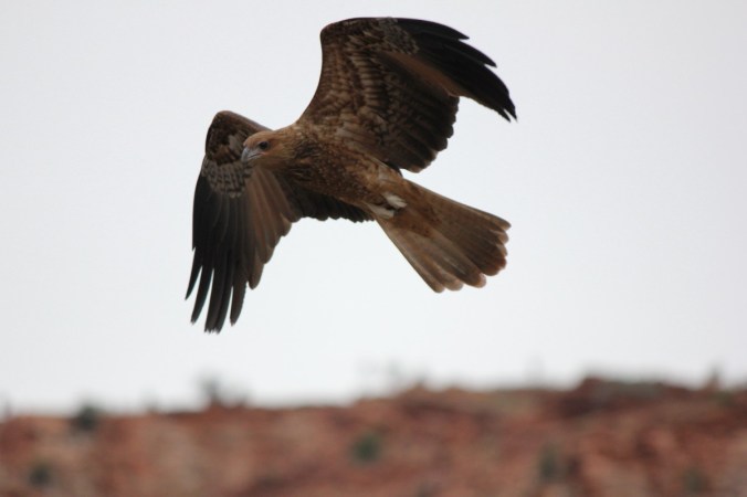
 Another very exciting exhibit at the Alice Springs Desert Park is the Birds of Prey demonstration. Keep your head low!! A couple of Kites put on quite a masterful aerial display.


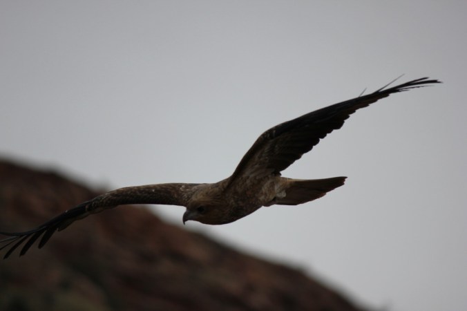


 Of course the star of the show is the mighty Wedge Tail Eagle. These are quite widespread across the country and we see lots at home but still they are impressive wherever you see them.
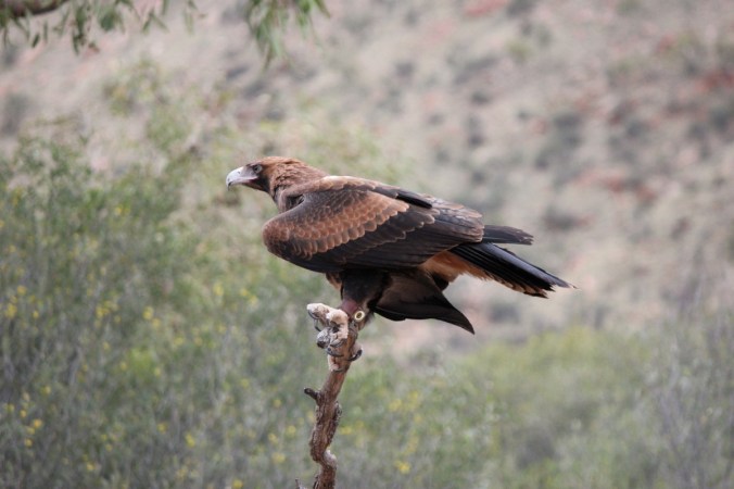
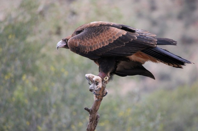

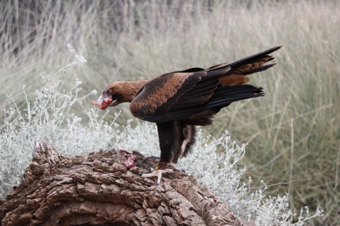 Check out his Wedgesticks(drumsticks) and not to mention his talons!

 And of course that big rudder at the back-wedge tail. Need to know more?? Click


 Of course there are plenty of other animals here, this is only a snapshot of a few. I will finish with one of our most iconic marsupials, Big Red. Macropus rufus.
 Cheers!